The storm bore down on my headwaters, as it had done to my sisters, and I couldn’t hold back. We were all overwhelmed and enraged; this was just another breakdown in my ancient age. So full my banks, so strong my force, I broke bridges and carried campers along my course. I threw their pieces with rocks and sand, reshaping your lives, reshaping the land.
“New” River, early Fall 2024
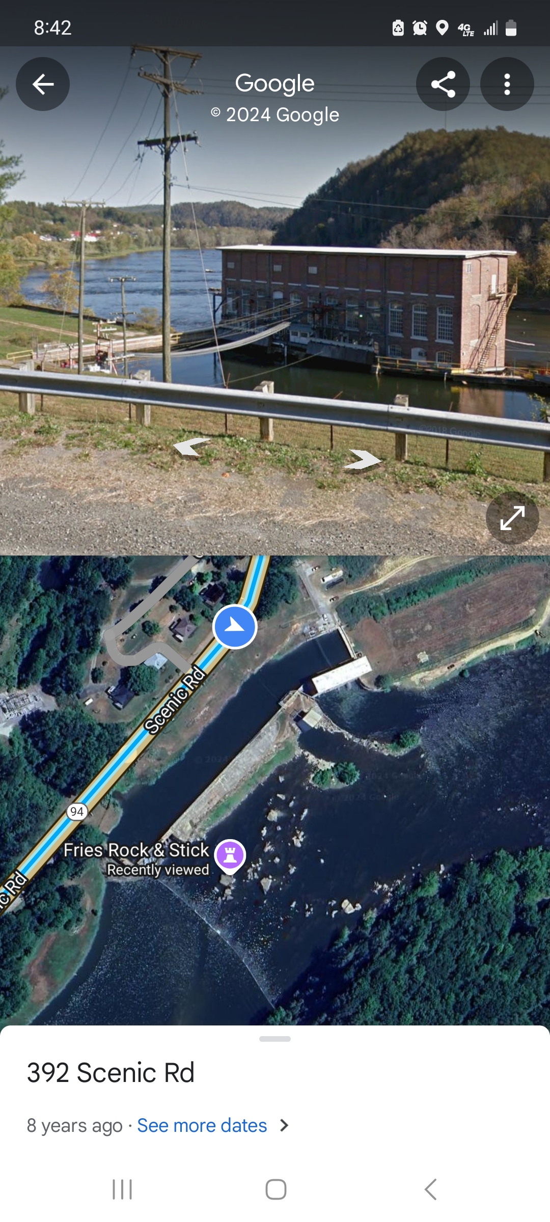
FRIES, VIRGINIA
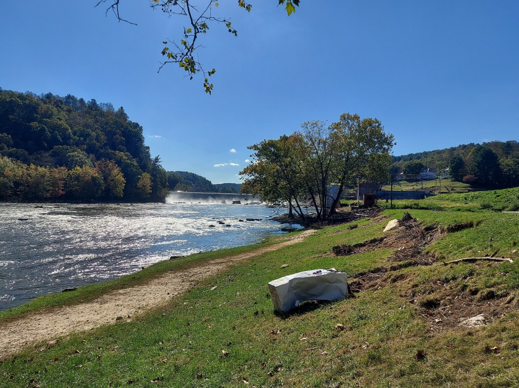
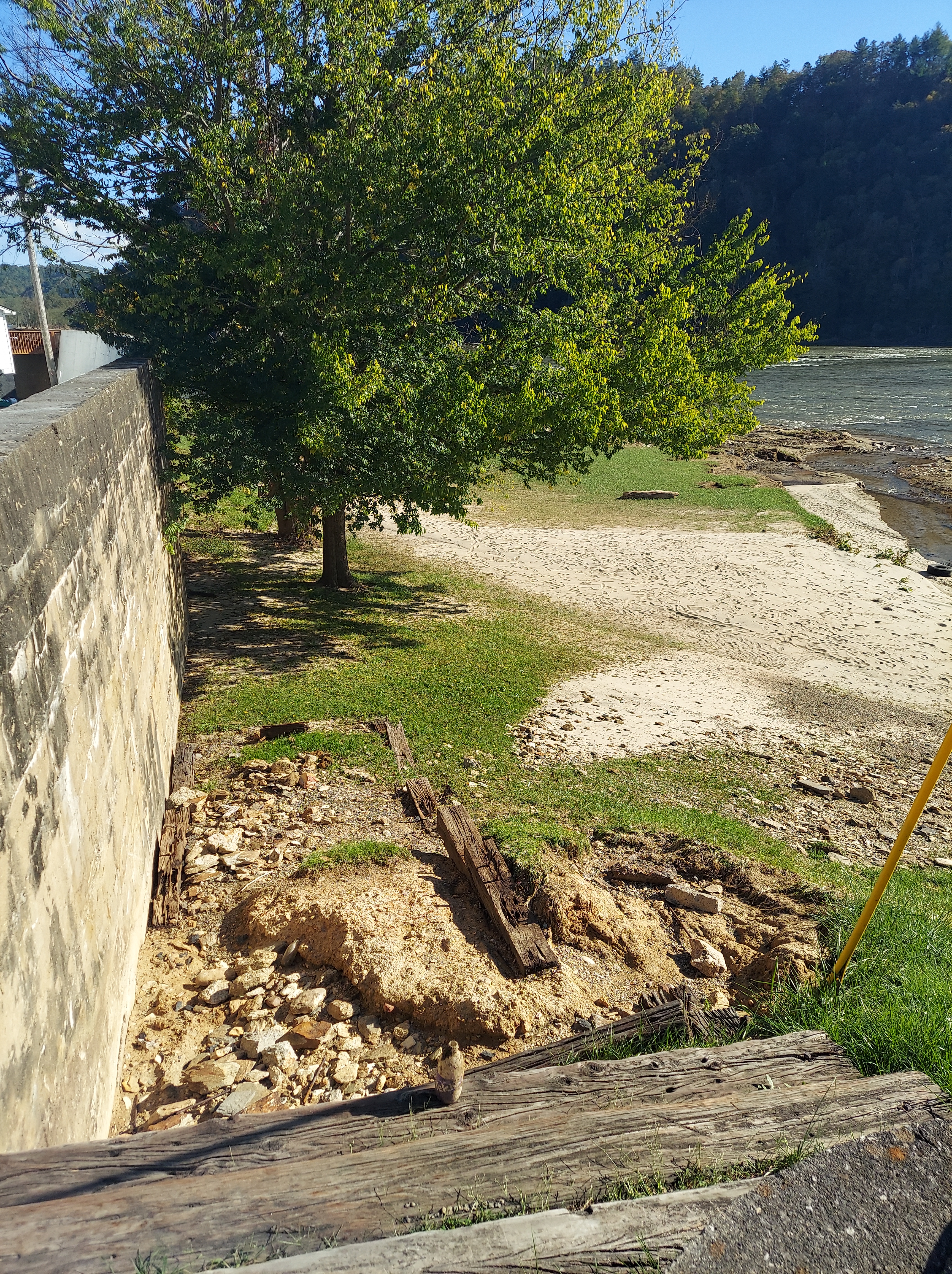
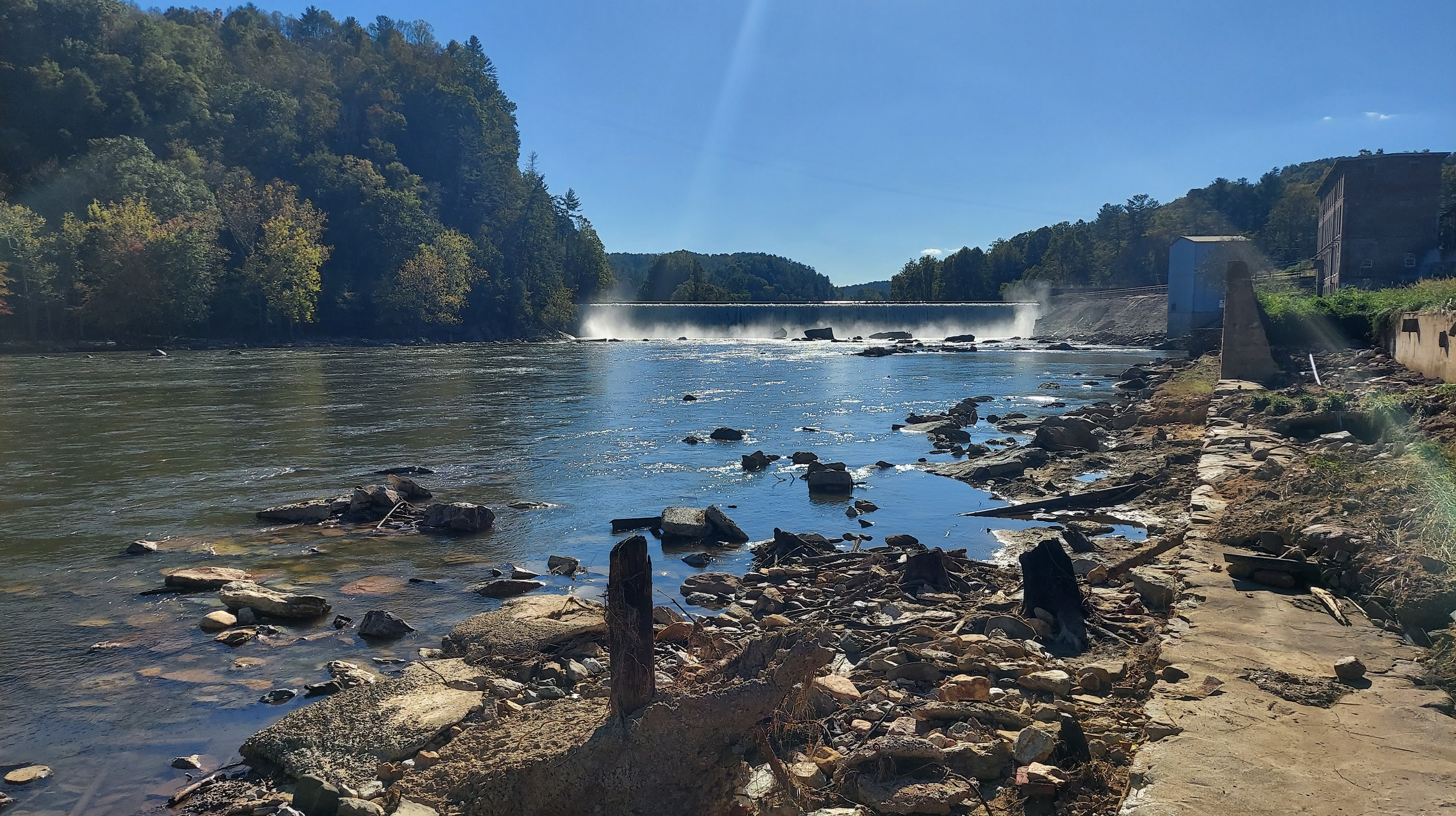
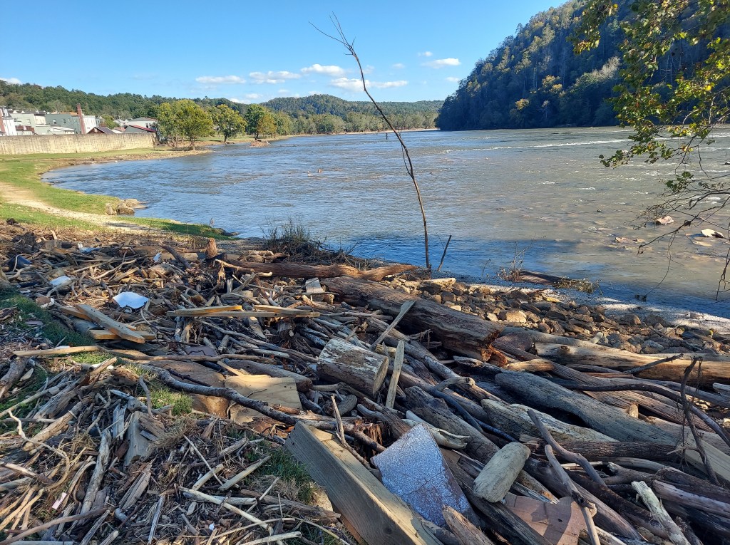
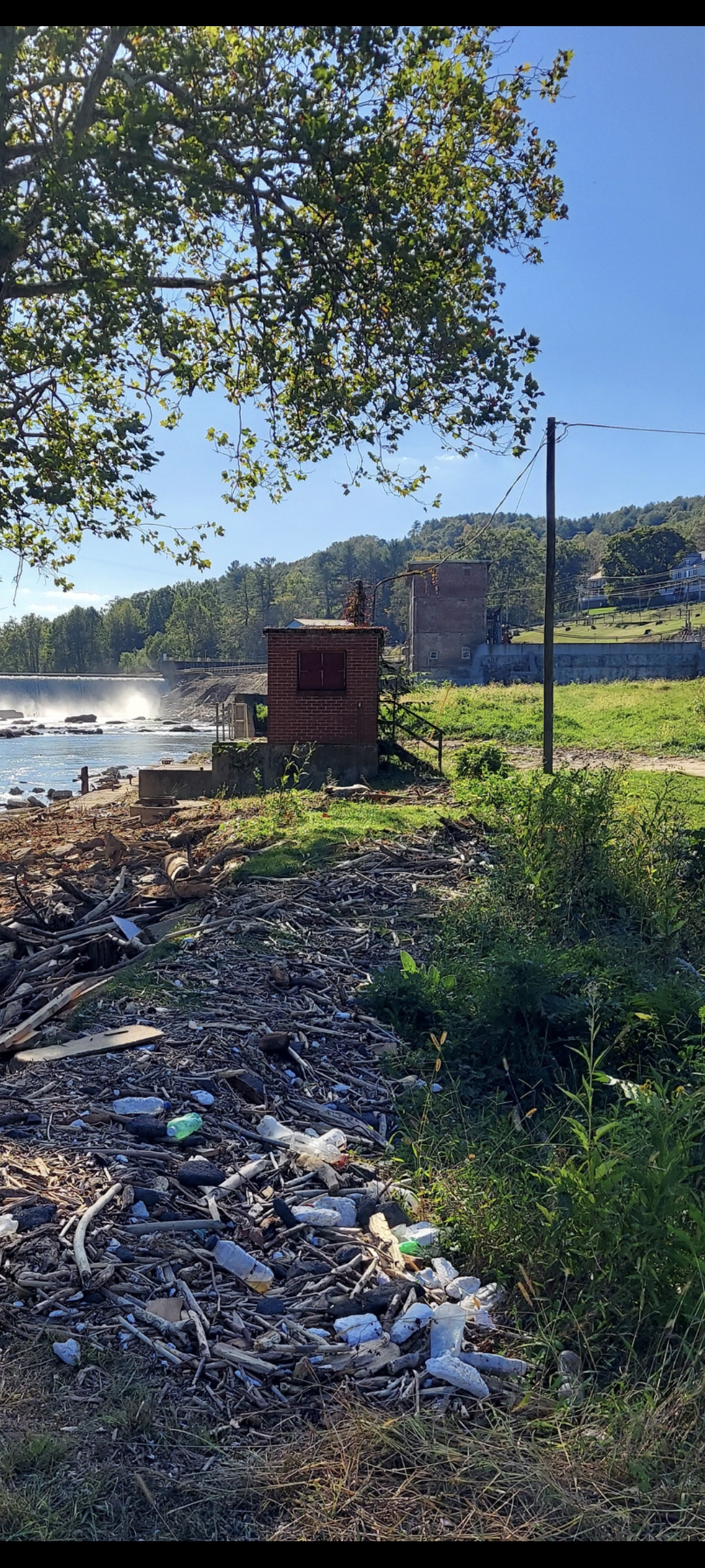
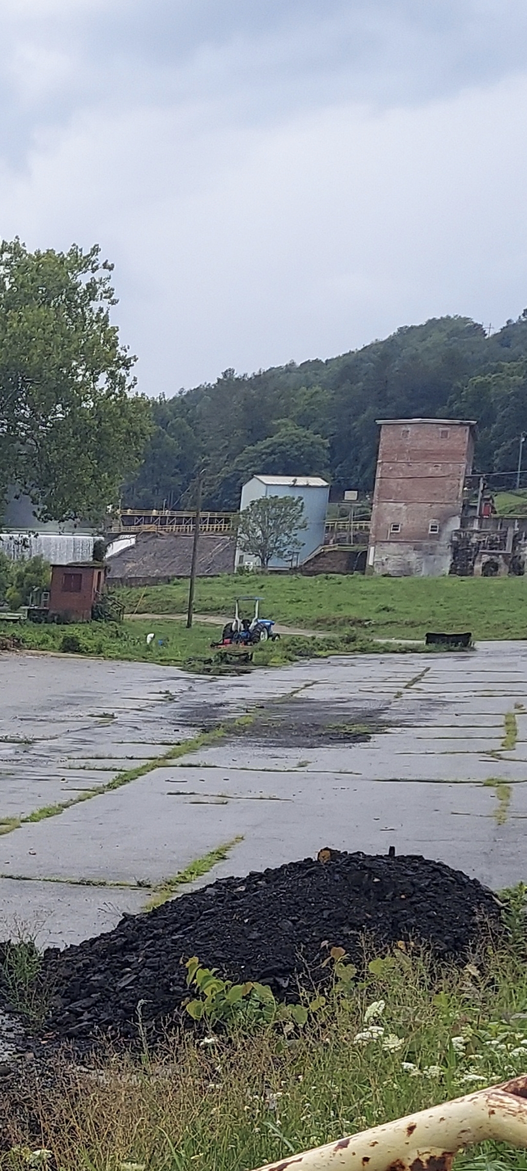
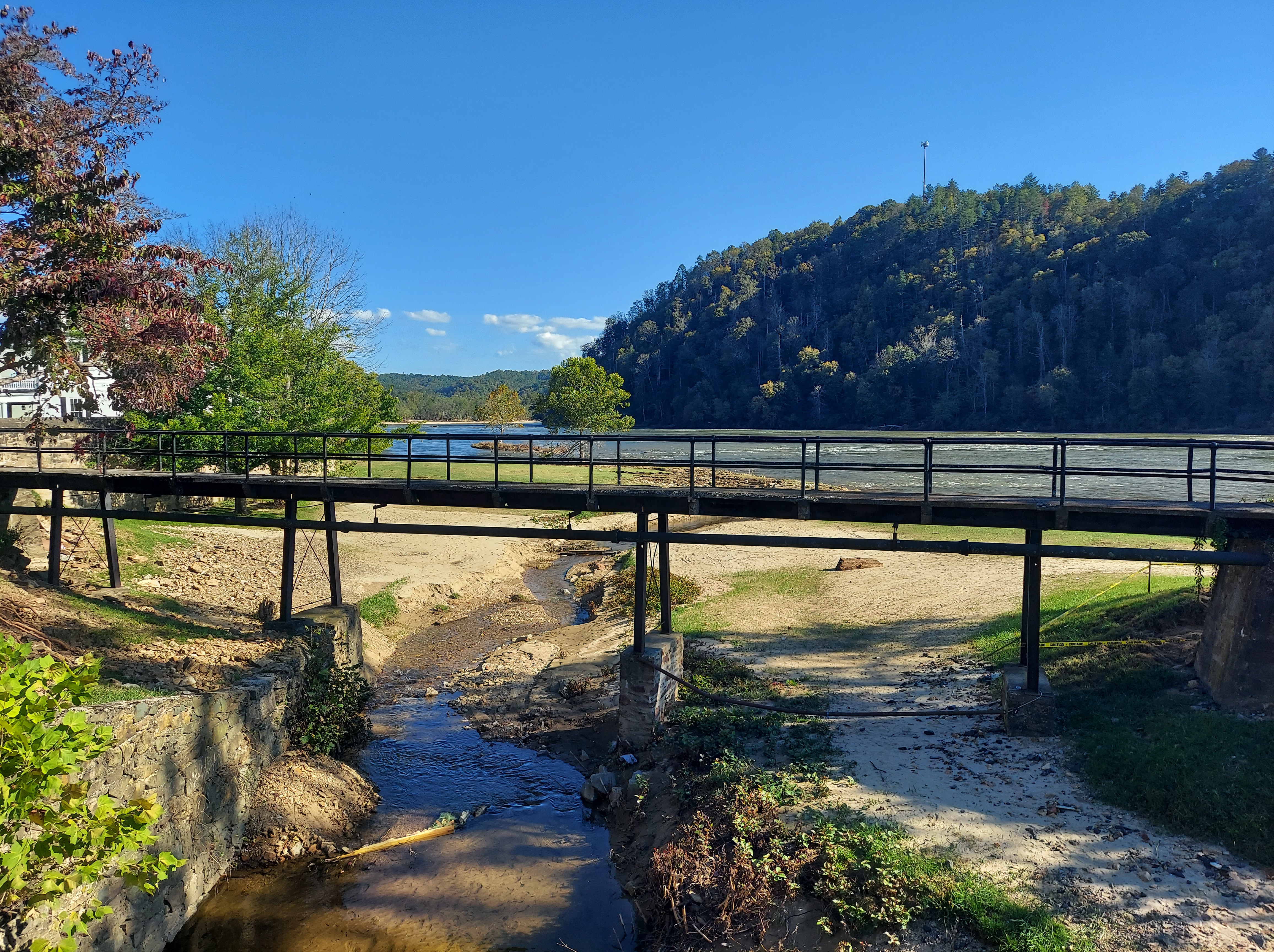
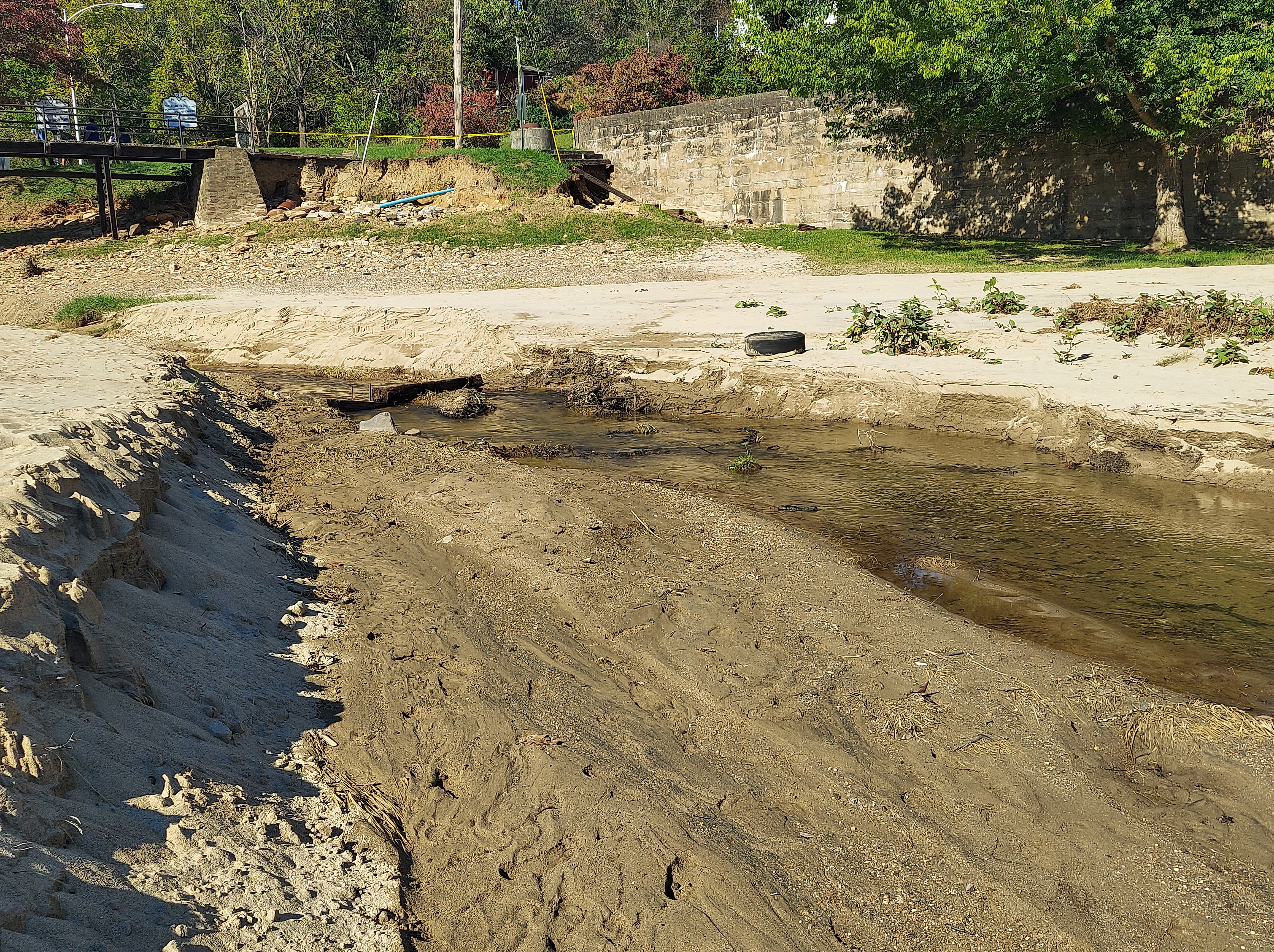
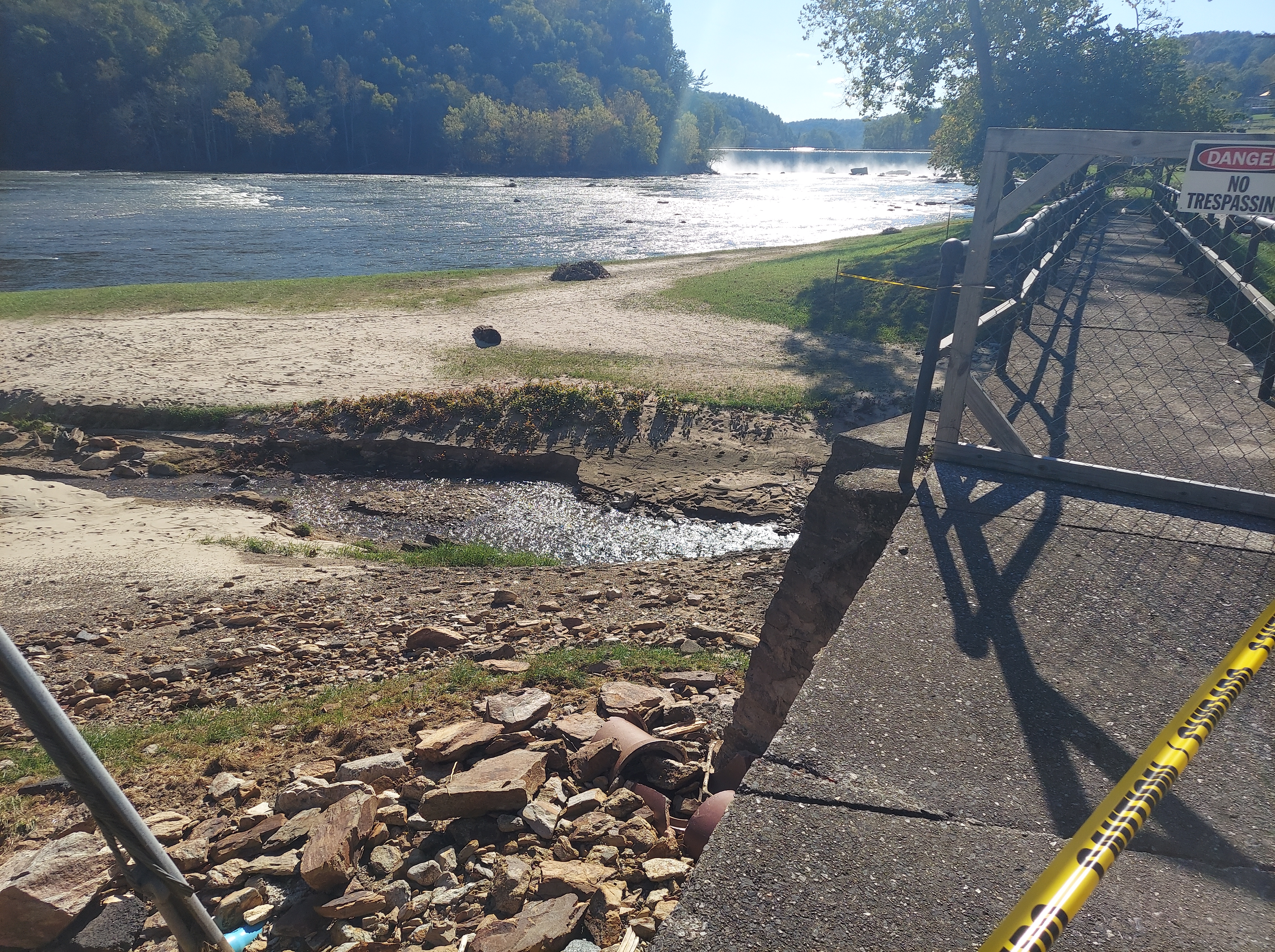
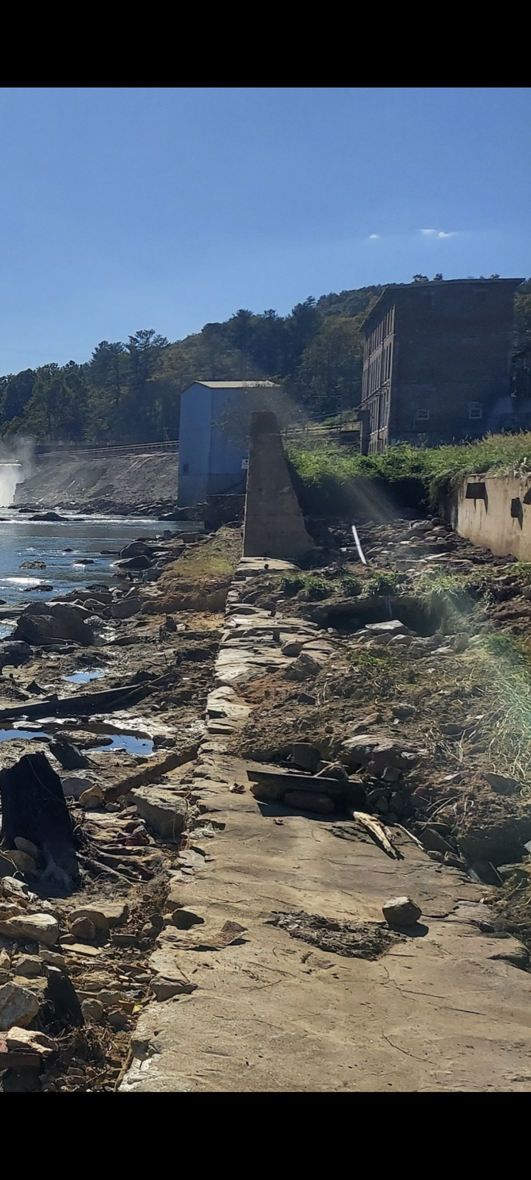
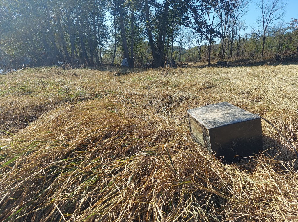
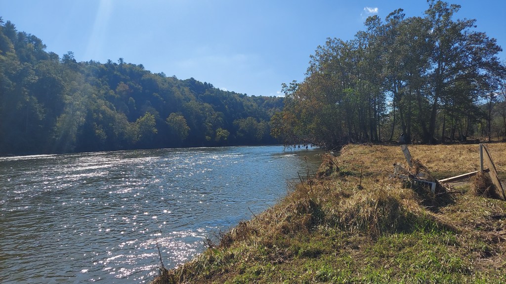
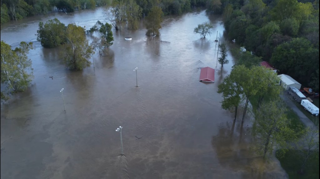
“There’s just… so much stuff…” a woman says to me as we pass each other on the new riverbank of sand, brick, wood, and rock where 10 days ago it was all grass. It’s a sunny, bright day, and the Fries historic mill dam is shrouded in mist. Adults and kids wander, observing what’s new. Bricks are scattered in shallow water. A crushed refrigerator lies by itself in the grass, feet from the shore. Above us all stands the wall built after the flood of 1940, protecting the town this time from the river’s torrent of rage below the dam.
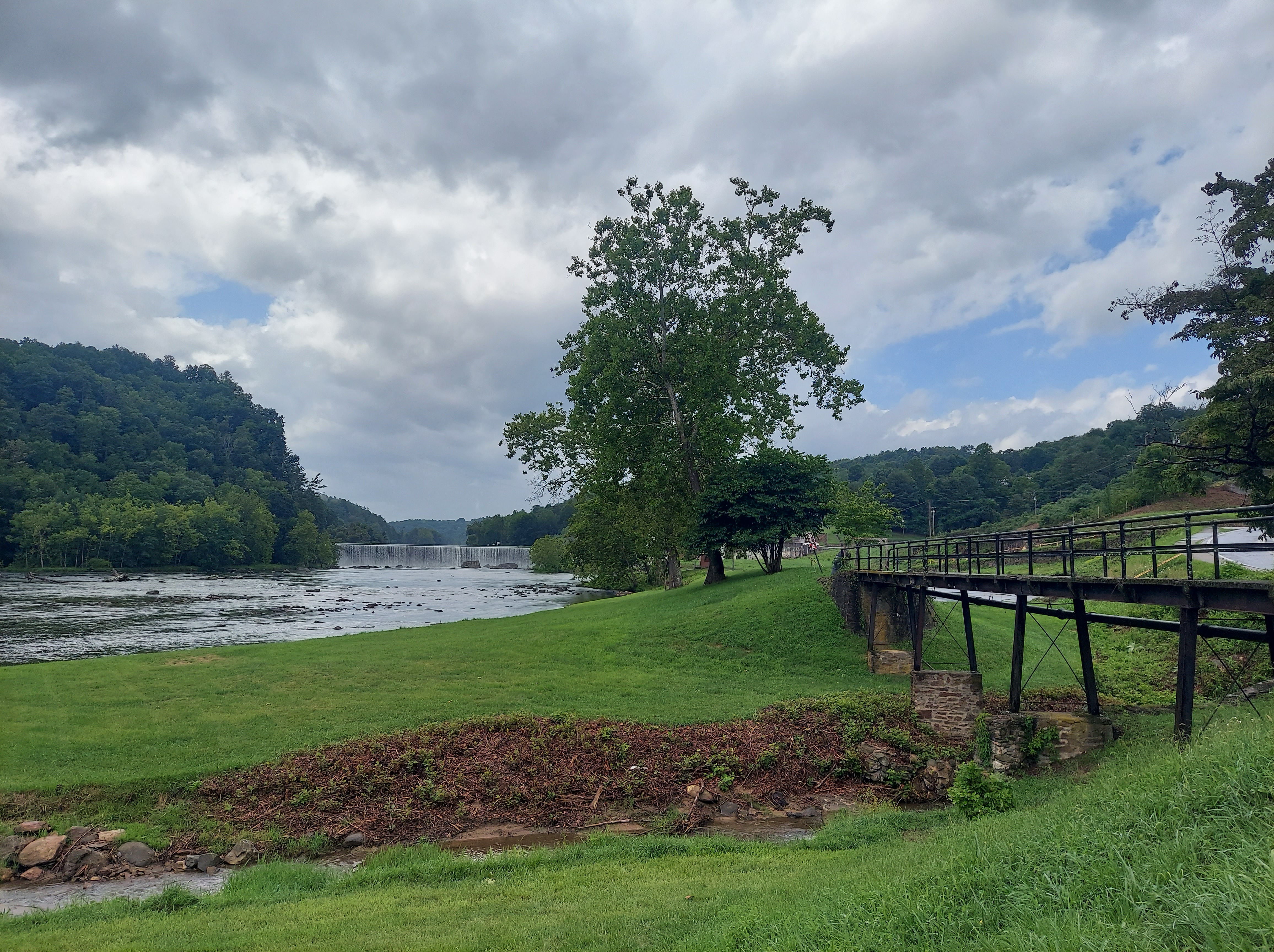
I was at this riverside park in August, coming into town via the now-flooded low water bridge. “Lush” and “majestic” are how I remember it now, but I wish I had walked closer to the dam and taken more photos to show the effects of Helene’s flood.
Because that water seeks her own/ She had a desire to flow/ She was looking for somewhere to go….
Charles Thompson (Black Francis), “St Francis Dam Disaster,” 2001
She carried in her every kind of thing/ Houses, trees, and telegraph poles/ Some say a thousand souls
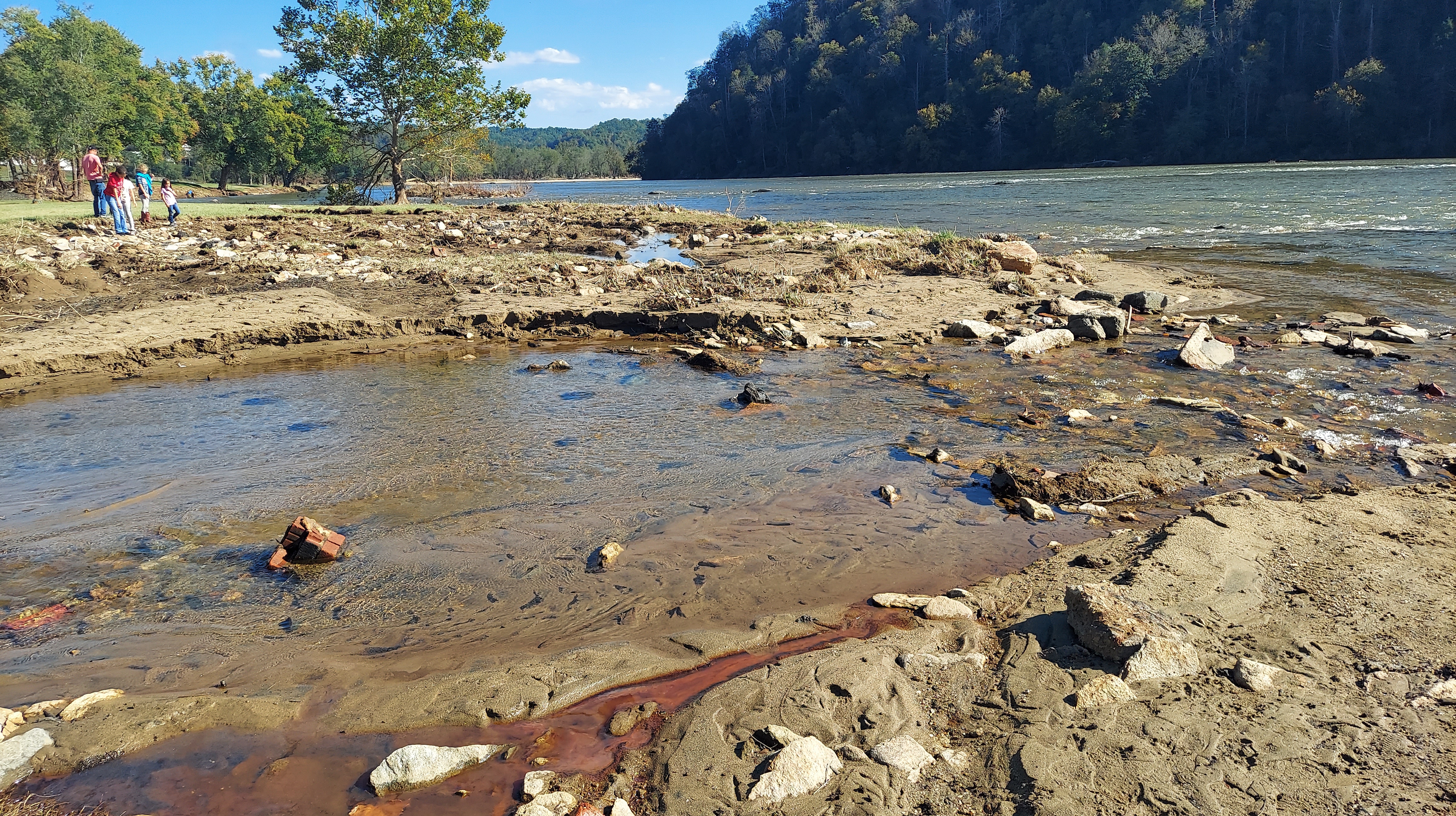
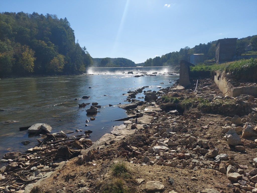
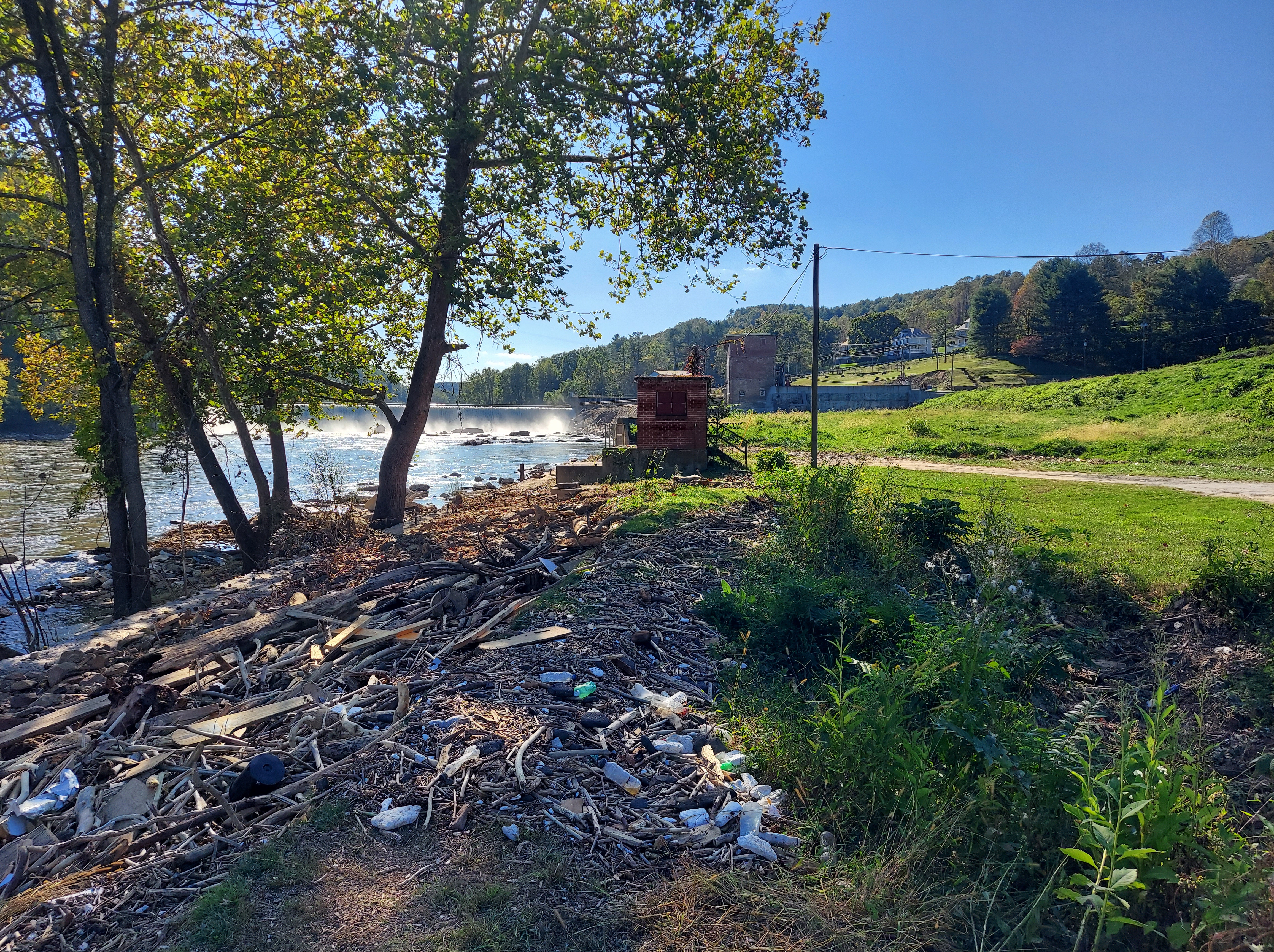
“There was a road here 10 days ago,” Mike Phipps, a Fries resident for 50 years, tells me as we stand on the remains of a lower wall on the riverside, looking up toward the dam. “It went all the way to the tailrace,” and now it’s gone. That giant rock sitting below the dam in the middle of the river, that’s new. The piles of debris show how high the river was, and “the water came about two-thirds high up that wall” [the tall one built after the 1940 flood]. During the past week, he says, people removed the canoes and other big things from the river that came over the dam. I ask him if he knows where the bricks came from; he’s not sure.
Video captured an RV camper coming over this dam, and apparently other RVs and boats went over, too. Note that it’s referred to as a “waterfall” in the caption (by the Weather Channel!) .
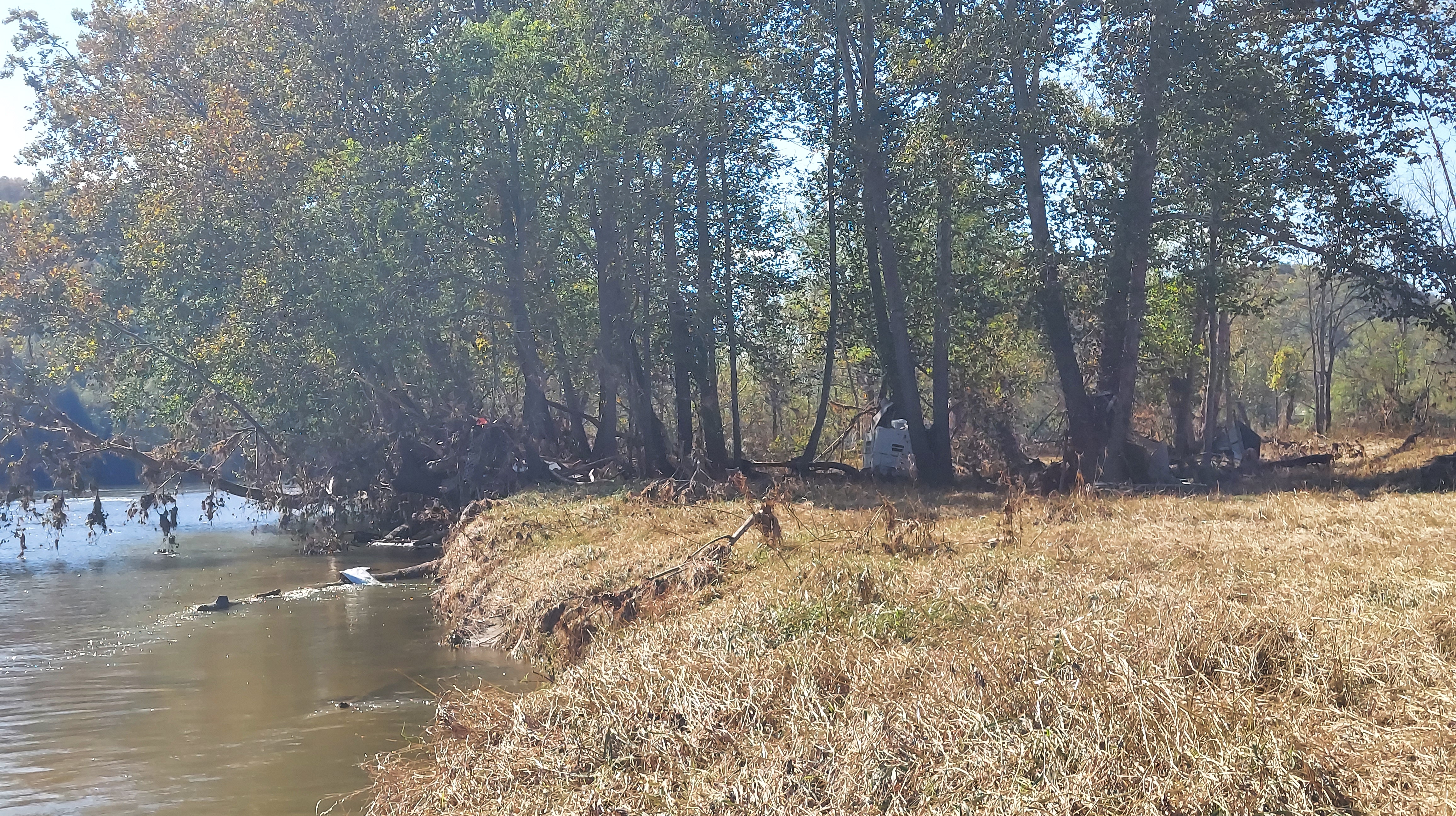
At a boat landing upstream a few miles from Fries, I see another RV in the mud amid the trees. It’s not safe to walk any closer to it due to the soft ground and streams beneath the thick brown grass.
IVANHOE
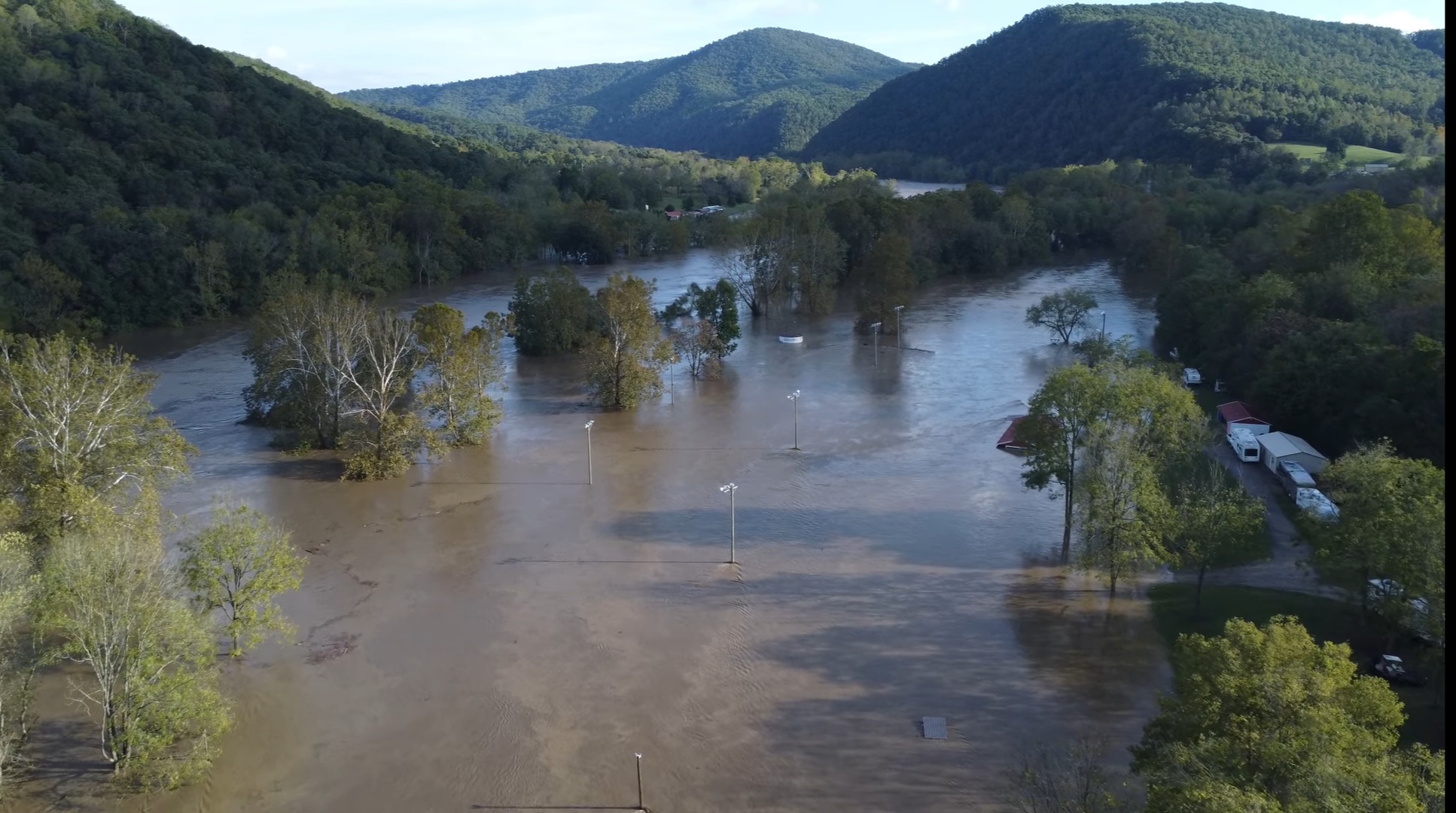
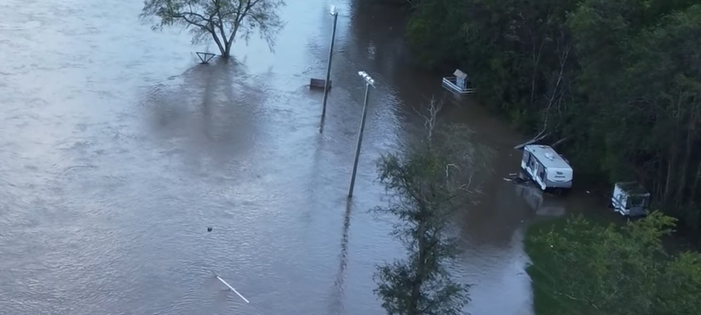
While buildings in Fries were spared major damage from Helene because of the high wall built after the 1940 “second great flood,” Ivanhoe, 11 miles downstream, was not as fortunate. Though I am worried for Ivanhoe, I don’t travel there in case it’s inaccessible. Drone video from Dan East shows the river flooding homes close to the river, and then beloved Jubilee Park almost up to the woods! Roofs of the concessions building and stage, and the light poles of the horse arena all can be seen sticking out of the water. Campers have been moved to the highest spots; hopefully this was enough to minimize damage. I don’t know how the main section of town fared (it’s separated from the river by a hill), but I will update if I find out.
THE DAMMED NEW RIVER
Fries Dam was the first to be built on the New River, 1901-3 for the textile mill that ran the town. 39 feet tall, it was built on a natural fall at a bend in the river. Fields dam, upstream at Mouth of Wilson, was built in 1930 to power a mill there, making it the first dam on the river’s course. Downriver dams include Byllesby, Buck (hydroelectric, both 1912), Claytor Lake (1939, hydroelectric) and then Bluestone in West Virginia (1940s for flood control), which caught much water and debris from upstream following Helene. http://www.virginiaplaces.org/watersheds/new.html
HISTORICAL FLOODS IN APPALACHIA
There has been so much misinformation following Helene that it’s important to consider the history of flooding and tropical cyclones in the Appalachian mountains.
Major floods from tropical cyclones (including hurricanes and their remnants) occurred in 1916 and 1940. Each were catastrophic across the region. The Swannanoa and French Broad (Asheville area), the upper New/Kanawha, Watauga (around Boone, NC), upper Yadkin (Wilkesboro, Elkin, NC), Pigeon (Canton, NC) and Roanoke Rivers all experienced record flooding in 1940, and many of the same areas flooded again with Helene and its preceding storm in 2024.
https://www.ashevillehistory.org/august-13-1940-the-second-great-flood/
Mortimer, North Carolina, a mill town in the Wilson Creek Gorge, was devastated in the 1940 flood and didn’t recover. It has been preserved by the Forest Service as a “ghost town,” which I visited in 2000 while exploring the area, but I didn’t know its historical context until this research. This area has suffered severe damage from Helene, but I haven’t been able to find any videos posted showing Mortimer.
https://www.ourstate.com/the-deluge-of-1940/
https://www.appalachianhistory.net/2018/08/north-carolina-ghost-town.html
The 1940 flood of the Watauga River damaged a section of the original “Tweetsie” Railroad near Boone, NC, causing that section to be permanently closed. Following the flood, NC highway 105 was built along this line. I remember visiting the Tweetsie Railroad attraction as a kid (it was the first theme park in North Carolina), and now it has suffered damage in the flood of 2024. The Watauga River also flooded in the 2024 storm.
GEOLOGIC CONTEXT
-Are north-flowing big rivers in the Appalachians (like the New and French Broad) more likely to flood?
Geologically, the rivers that flow inland across the mountain range cut across the sedimentary rock folds of the Ridge-and-Valley and the dissected Appalachian plateau. They create long, deep valleys which carry sediments into them from upriver. The New/Kanawha River does all of these as it meets the present Ohio River and then flows west from the plateau into the Mississippi lowlands.
The “French” Broad flows north in a long valley through Asheville and part of the Ridge and Valley, but then it feeds into the Tennessee River, which flows southwest around the edge of the plateau (through a series of large dams).
But the geology of Appalachian watersheds is more complex than this, and I explore a lot about this in different posts in my blog as I study it.
We can make it to the road in a homemade boat/
Johnny Cash, “Five Feet High and Rising” (1959)
That’s the only thing left that’ll float/
It’s already over all the wheat and the oats/
Two feet high and risin’
It was a winter 1937 Ohio River flood that inspired Johnny Cash to create “5 Feet High And Rising.” Cash, as a child, lived near the Mississippi River on the Arkansas side across from Tennessee, downstream from the confluence of the Ohio River. The New/Kanawha River is in the eastern, upper part of this watershed.
And I went and stood up on some high on lonesome hill/
Bessie Smith, “Back-water Blues” (1927)
Then I looked down on the house where I used to live
Prior to European colonization, there probably were major floods affecting tribal communities. I think about the Mound-building cultures and their cities that were built in river basins around the mounds, which may be the only evidence that remains above ground. Residents of Cahokia, Coosa and Cowee may have had a flood story to tell their descendants.
https://popular-archaeology.com/article/cahokia-s-rise-and-fall-linked-to-river-flooding/
While climate change contributes to the frequency and intensity of storms, topography and geology of the mountain valleys make it especially vulnerable to flash flooding. The river gives life, then on occasion she takes it away.
Storm recovery resources for North Carolina can be found here:
https://www.ncdoi.gov/hurricane-helene-response-and-recovery
And for Virginia, here:
https://www.vaemergency.gov/
