Happy harvest moon from the Northern Atlantic Woodlands! While the sky was cloudy enough last night to almost obscure the moonlight, I was able to spend an evening in its glow over the weekend out at Drekheim (and we howled!).
With pleasant weather amid an eventful month (in good and bad ways), nature time has been necessary for mental health. So, on the way to a gig, I stop to hike at Occoneechee Mountain instead of just driving across it on I-85 like usual.

The previous time I hiked here, it was winter, 2010, with the Back Pockets. We were on tour, from Atlanta, on the way to play a show in Durham that night. After that show, the entire band would sleep at my parents’ house because we didn’t find another place to stay.
I don’t remember whose idea it was to hike Occoneechee Mountain, but it was cold and cloudy as we hiked to the summit. I remember seeing a sign for “Elfin Trail,” and then we talked about seeing an elf near the summit. Aside from this “elf,” we saw no other hikers because it was so cold out. But we missed the most interesting parts of this State Natural Area.
Occoneechee Mountain, at 867 feet above sea level, has the highest elevation in Orange County, NC. I-85 and I-40 cross its gentler southern slope, but its steep northern slope drops with rocky cliffs to the Eno River. There are lush river bottomlands, a high overlook, and a former pyrophyllite quarry on the cliffside in between.
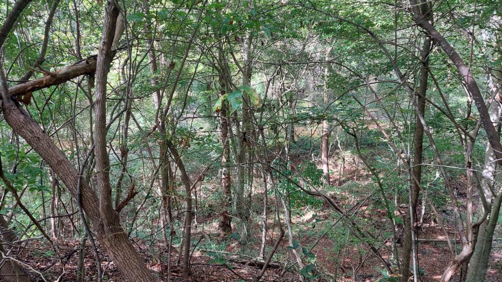
This visit, I park on the gravel spaces along Eno Mountain Rd near the river. This trail begins evenly through the woods, then meets the loop trail where one can go up toward the overlook or down toward the river.
THE RIVER
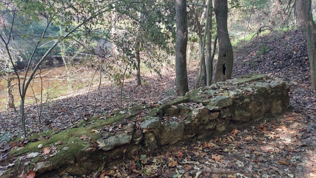
Fallen trees and debris from Tropical Storm Chantal in July still lie in and near the river, but trails are mostly clear and accessible.
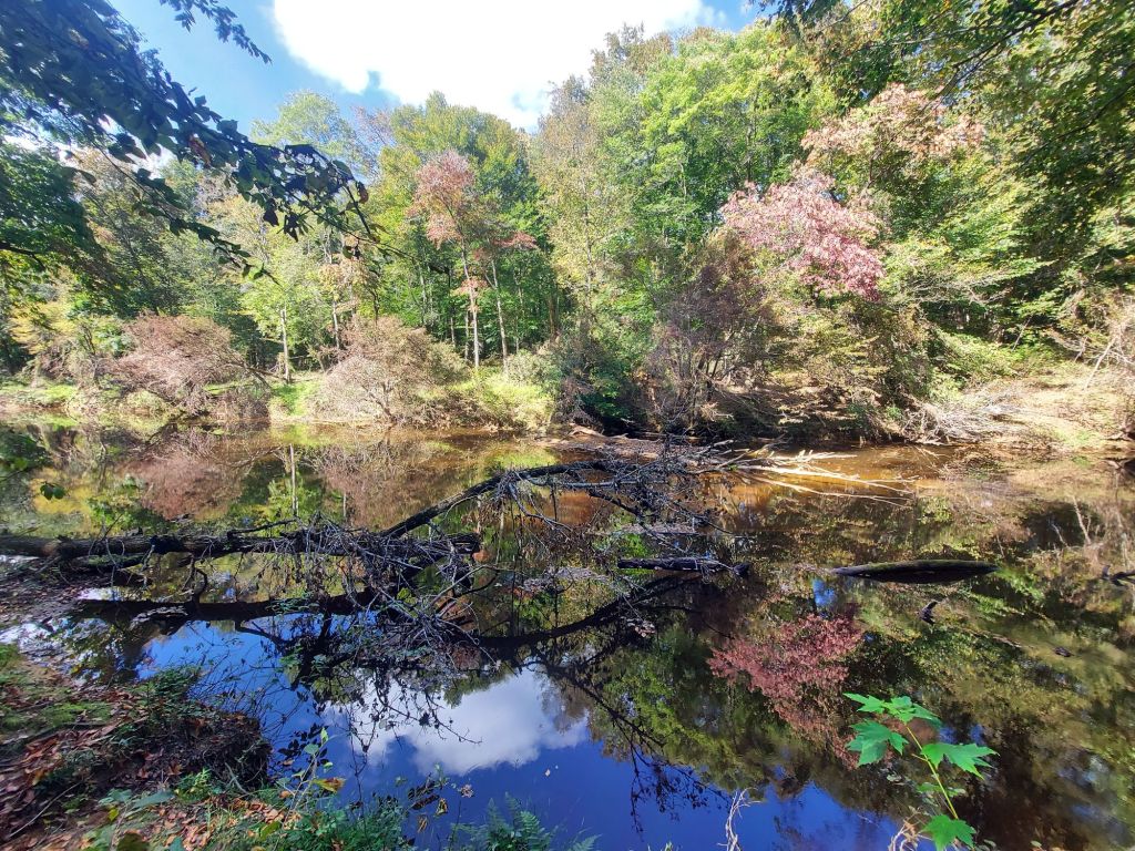
Rocks of different colors support me as I descend, then ascend on return. By the river, large outcrops tell some of the mountain’s geologic story.

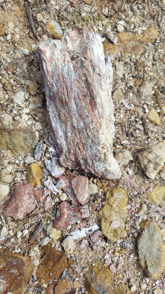
Some of the rocks arrived over 600 million years ago, as small volcanic islands were pushed into converging land masses when the ancient Appalachian range was forming. Rocks heated with groundwater underwent a low-pressure metamorphosis (hydrothermal alteration), hot springs and geysers formed, eventually creating soft pyrophyllite and hard quartz around the NC Piedmont.
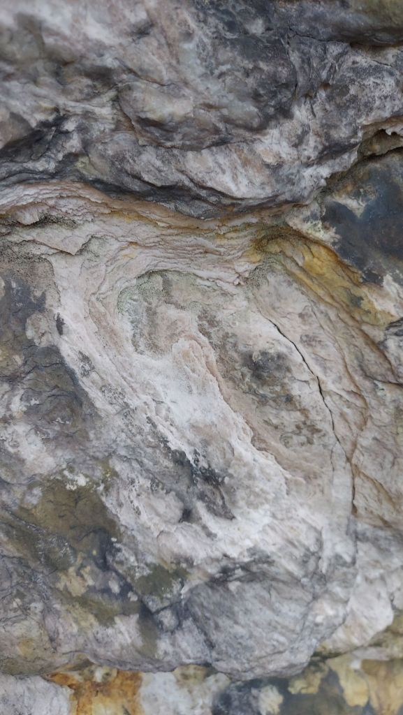
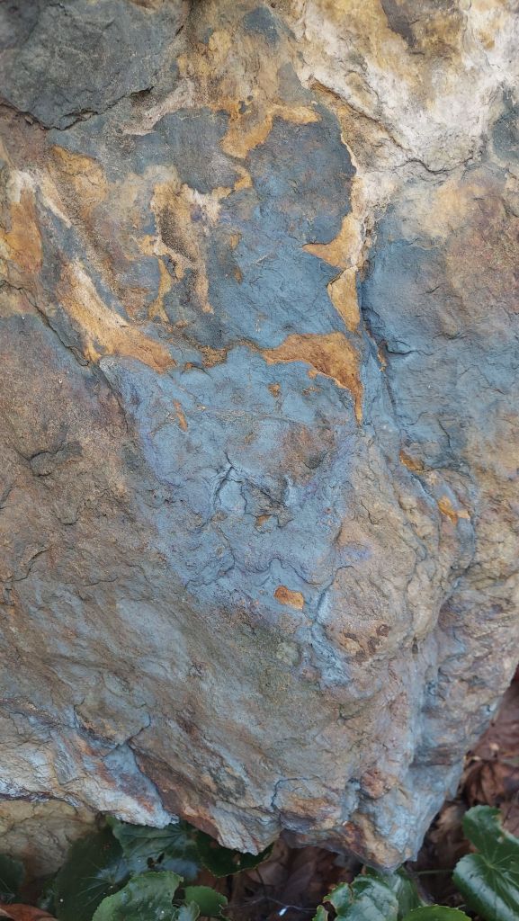
The blue/orange/brown rock formations are harder than the white-pink rock but are still somewhat soft and flaky. This reminds me of “Duke Stone” used in buildings on Duke University Main Campus, and it’s probably a form of slate (said to be blue Quartzite with Iron Oxide).
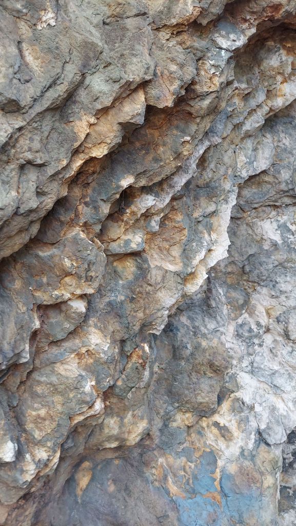
The Eno River cut through these mountains, eroding softer rock and exposing harder formations. Not far downriver, the Eno flows into the Triassic Basin, a geologic area I visit a lot, including northern Durham. The basin formed about 225 million years ago as Pangaea separated and is composed of mostly sedimentary (not-metamorphosed) rock like shale. Occoneechee Mountain, by contrast, is considered part of the Carolina Terrane, or Slate Belt.
THE QUARRY AND OVERLOOK
Rising above the river lowland, the old quarry comes into view. The cliff is majestic and steep, as a tree-covered path opens into sunlight. Rocks are scattered loosely on the hillside from a 2001 slide, and so it’s not safe to ascend more. A “no climbing” sign is posted near here, too.
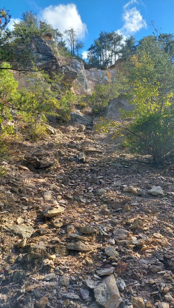
Climbing stairs continues this hike uphill on the loop trail toward the overlook, which is at the end of a short spur trail. From the river to the top is about a 300-foot elevation change.
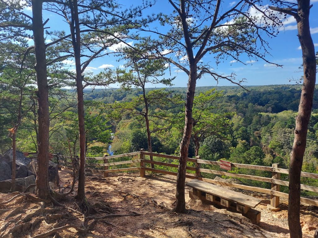
From the overlook, views northward of the river and far beyond reward us. Parts of the quarry are also visible, looking down (called “Panther’s Den” on some maps).

And a sign near the trail spur indicates the “Brown Elfin Trail” to the summit, a reminder of that cold hike with Em and the Back Pockets in 2010. (The Brown Elfin, I find out, is a species of butterfly typically found in cooler climates and higher altitudes).

Also worth mentioning is the name “Occoneechee,” referring to the Occaneechi-Saponi people and an indigenous settlement that was located here. This name is also applied to the historic Speedway downriver on the Eno, which I visited in 2024, and a reconstructed Native village on the Eno Riverwalk next to downtown Hillsborough. These sites are all connected by the Riverwalk, a part of the Mountains-to-Sea trail, and all can be visited together.
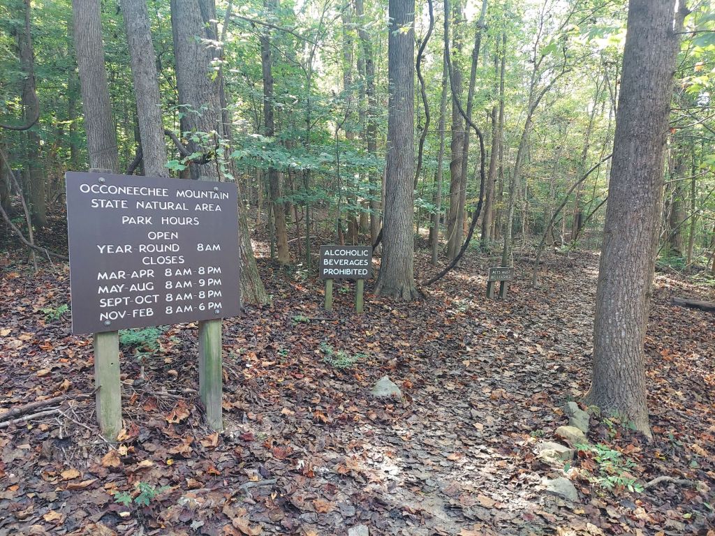
Occoneechee Mountain State Natural Area is free to visit, managed by nearby Eno River State Park. Some sections of the State Park are currently closed due to damage from Chantal, so check the website for updates on access and seasonal hours. There is a main parking area, and the roadside parking near the river which I used today.
For deeper information about the geology of Occoneechee Mountain and the upper Eno River, the NC Geological Survey & NC DEQ have a document “A Geologic Adventure Along the Eno River” by Philip J. Bradley. It is also a source for some of my information, but I can’t share the link here.
Mark All My Words has also written about hiking Occoneechee Mountain from a geological perspective.
This Saturday I’ll be at FLART Market in Durham (the Triassic Basin) set up with jewelry, as Starri Ari Stones/Stories from the Earth. Hope to see some of you there!
Also, by coincidence, the Occaneechi band of the Saponi Nation are having their annual pow-wow this weekend (at their tribal grounds near Mebane, NC). https://obsn.org/
To self-care and to enjoying each other and our communities! Until next time,
Arianna
