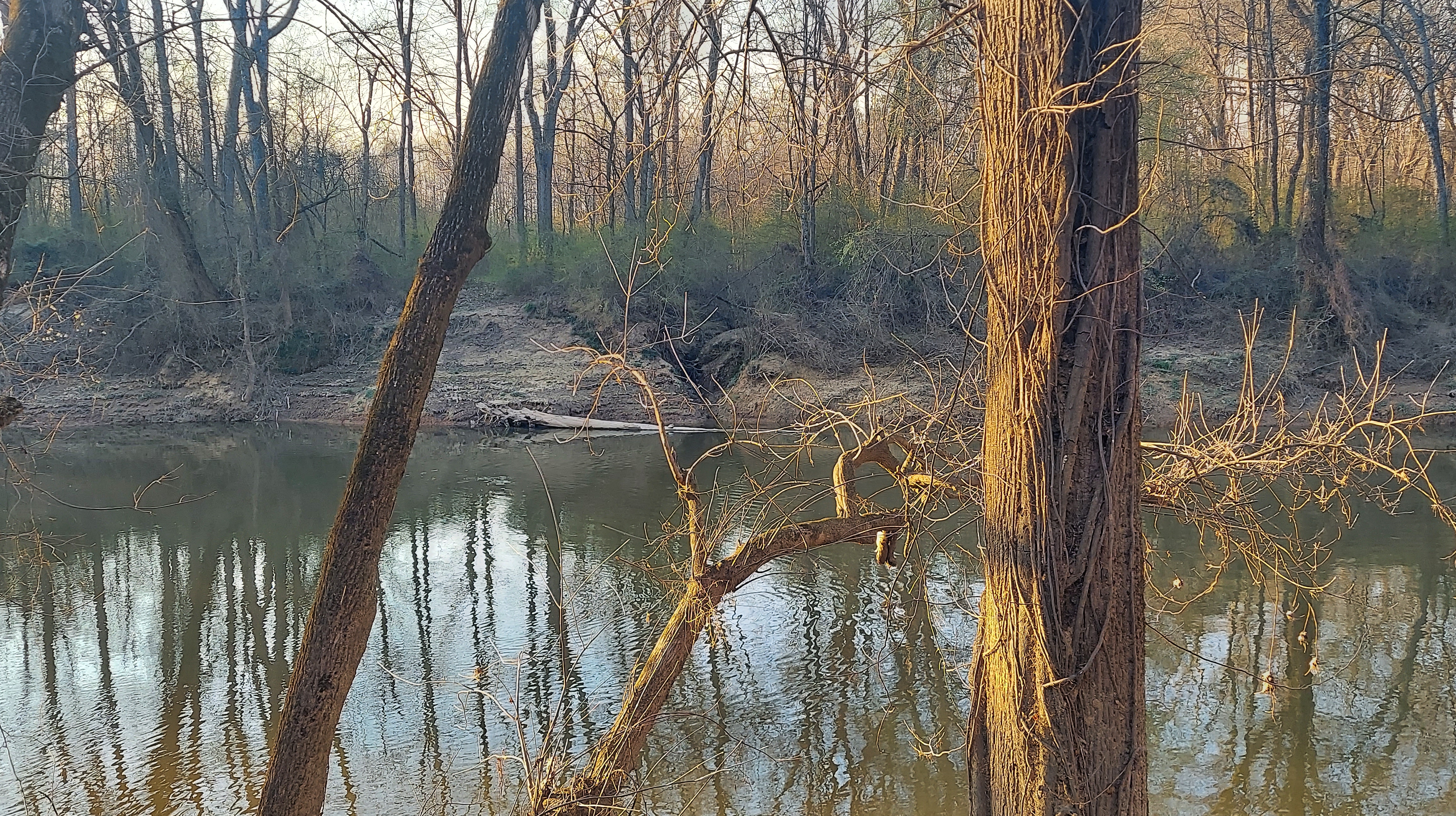
Somewhere in the middle of the Piedmont, a rocky river becomes silty and muddy and changes direction.

Called the Deep River, it gives its name to the southeast’s largest Triassic rift Basin.
The name “Deep River” is a translation of an indigenous name, sapponah (sappony), which, beyond this, has vague (conflicting?) sources but most likely came from seep-moni, “shallow water” — note Moniseep Ford on the Roanoke River, a noted crossing on the historic Trading Path used by Saponi and other native people. It is also said that the name “Deep River” refers to the steepness of the banks, not the depth of the water. For 125 miles it flows, mostly south-southeast, but then decisively turns northeast for its final ~20 miles until it meets the Haw (sis’sipahaw), its larger sibling, to form the Cape Fear at Moncure.
It is this ~20 mile section that I am exploring.


It’s a warm, bright and breezy afternoon in Carbonton. The river burbles in the background; crickets sing then rest. I step across soft, tan earth to an old wooden table for a picnic in view of the old dam site. What a beautiful spot.
THE CARBONTON DAM powerhouse stands as a painted brick beacon over the river from the bridge in either direction. This is most of what remains of the first hydroelectric dam in this area, built for CP&L in the 1920’s and demolished in 2005. It’s hard to picture a concrete dam breaking the flow of the river here, but easy to understand the appeal of this geographic location: On one of a series of bends, where the river generally turns to the northeast after a transition from rocky to silty ground, near a well-traveled Piedmont pathway.

Previously the site of O’Dowd Mill (~1760-1791) built by Irishman Connor Dowd, then Tyson’s, Roberts’, Evans’ and Stewart’s mills through the 1800s, the small rapid has been dammed in different ways throughout its Colonial era. The Cape Fear and Deep River navigation company had their way with it beginning in 1848. And for now it is an unmarked public park, accessible and flowing freely.

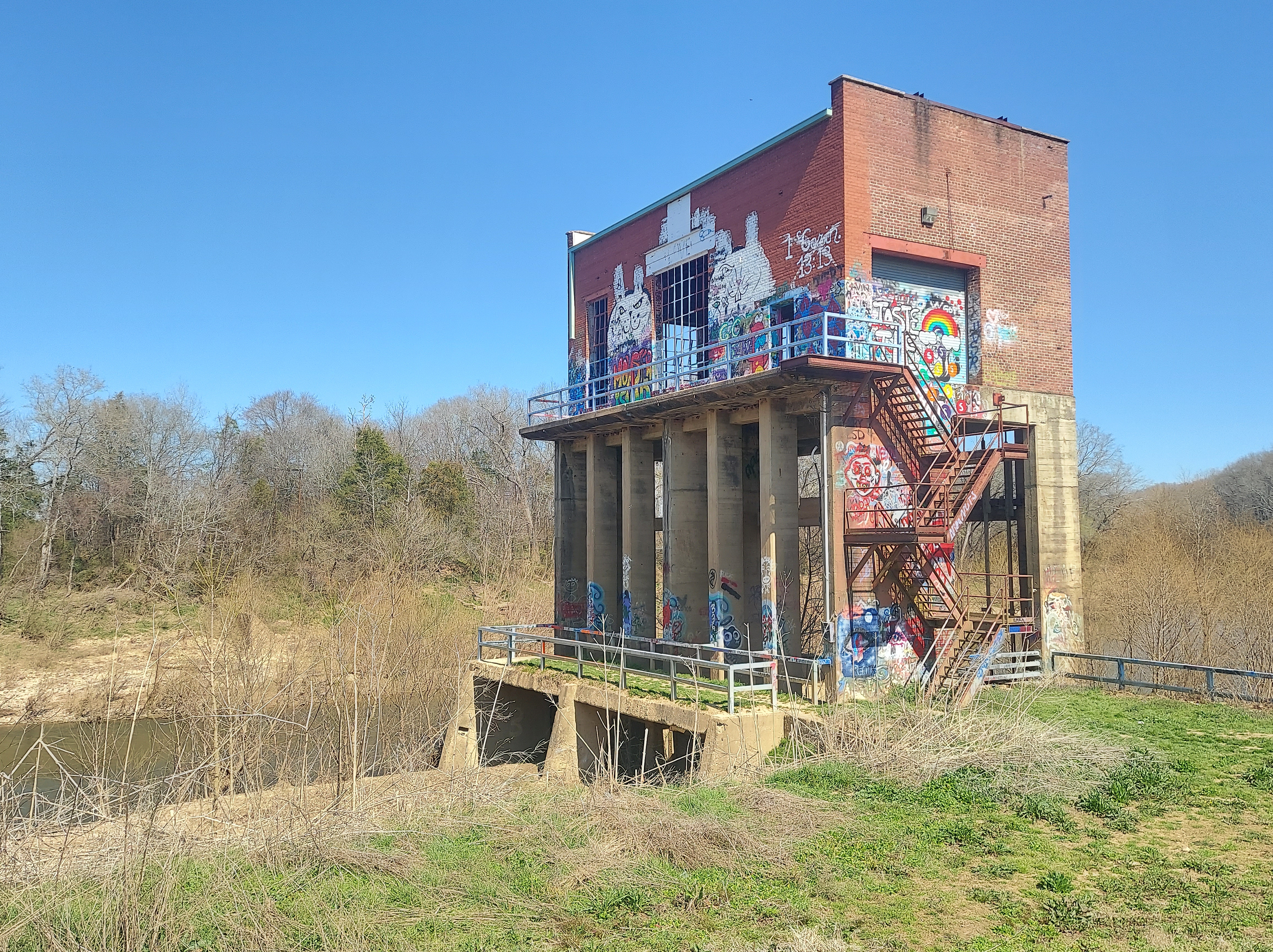
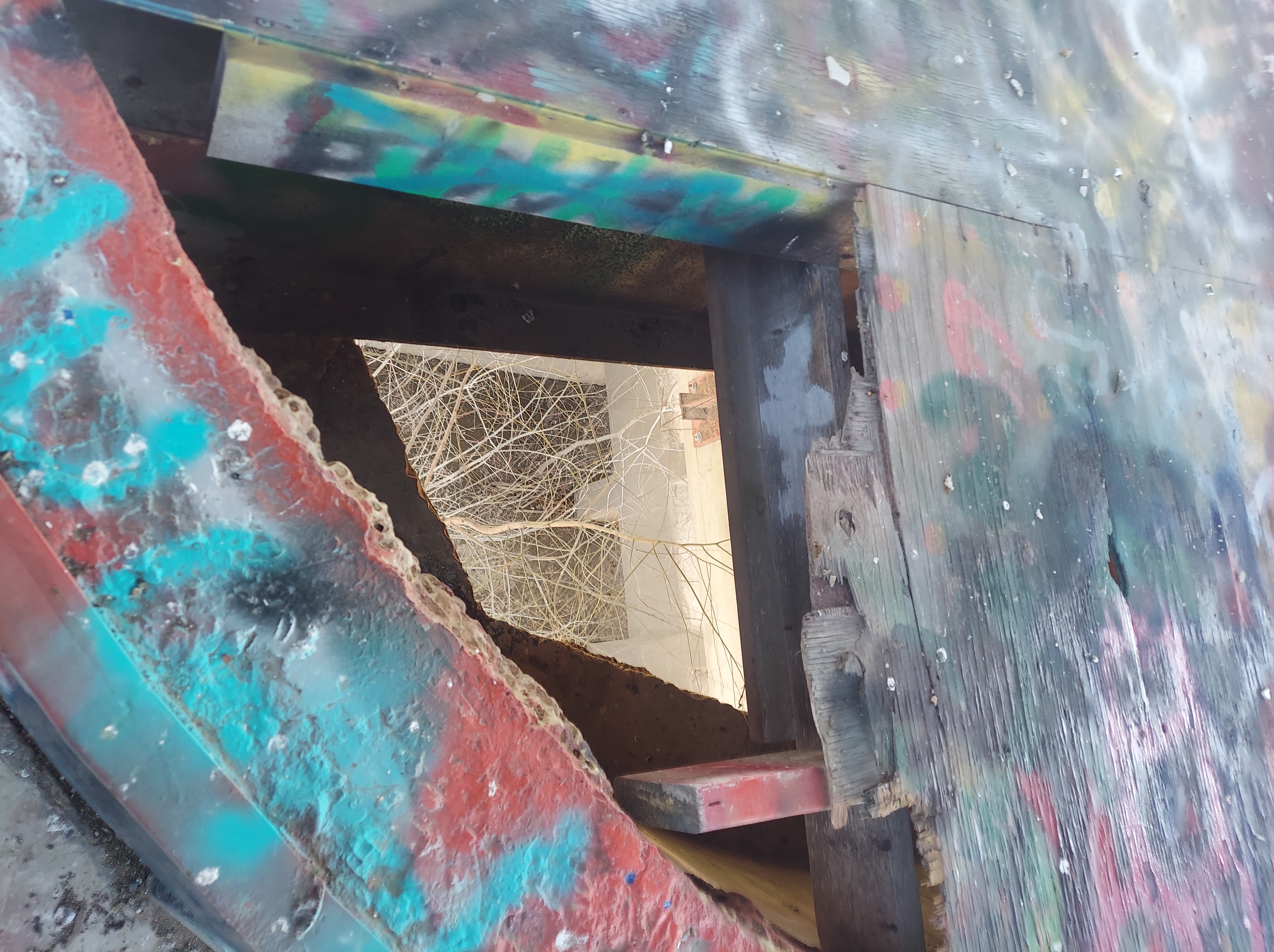
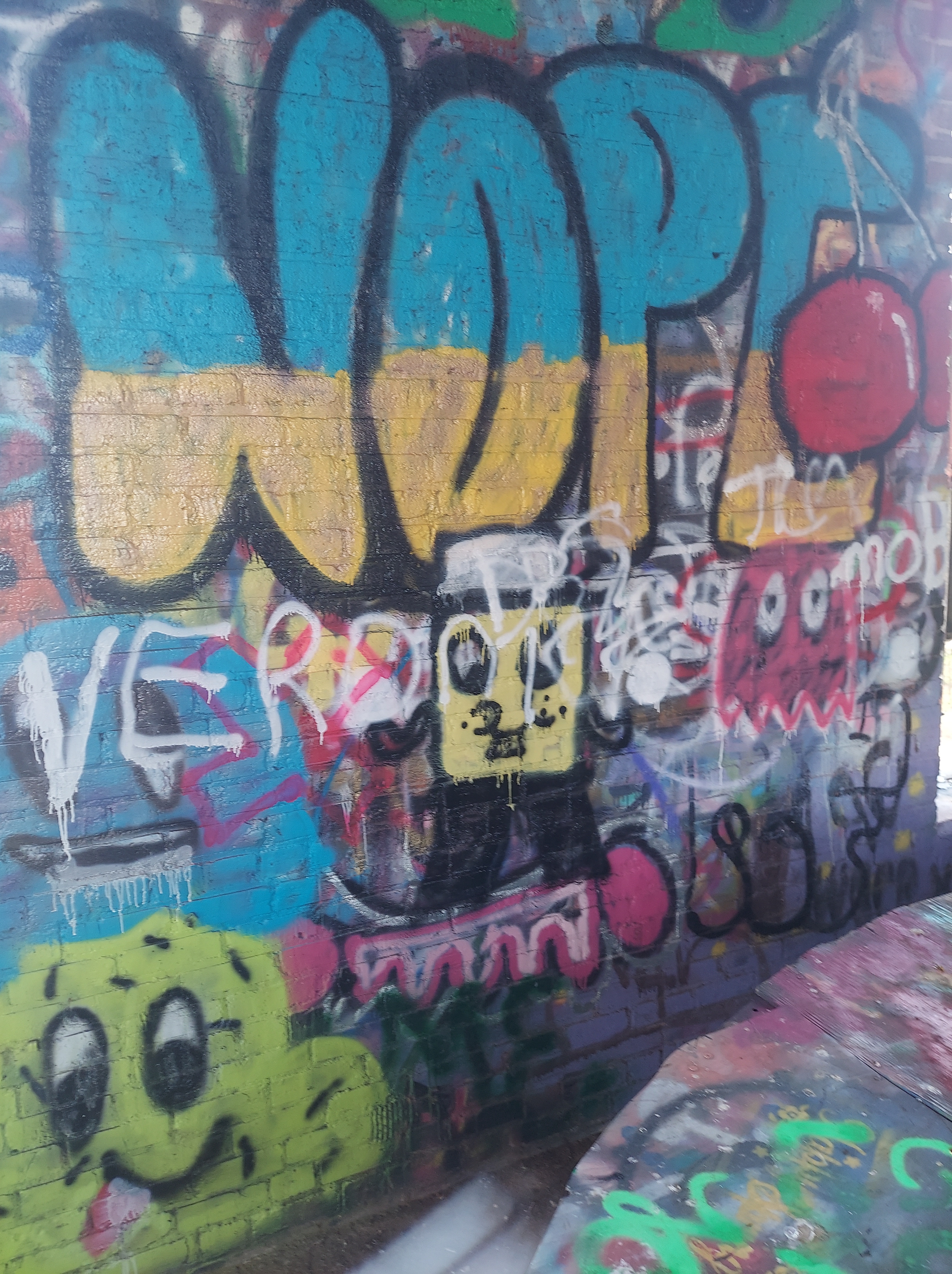
As I sit here, a couple argues loudly in a car; she leaves on foot, then he calls her to come back from the dirt lot, and eventually they ride away together. In solitude, I ascend the rusty metal stairs of the powerhouse that sway slightly but are still structurally sound.
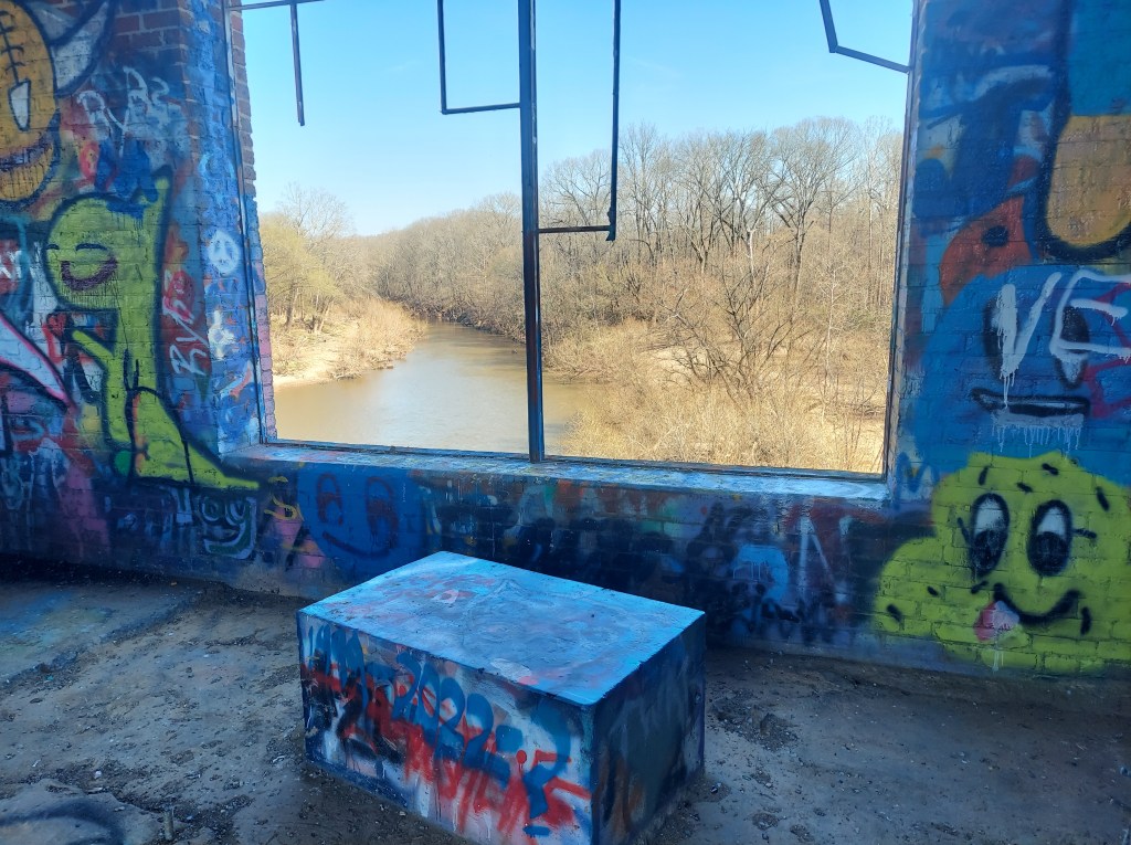
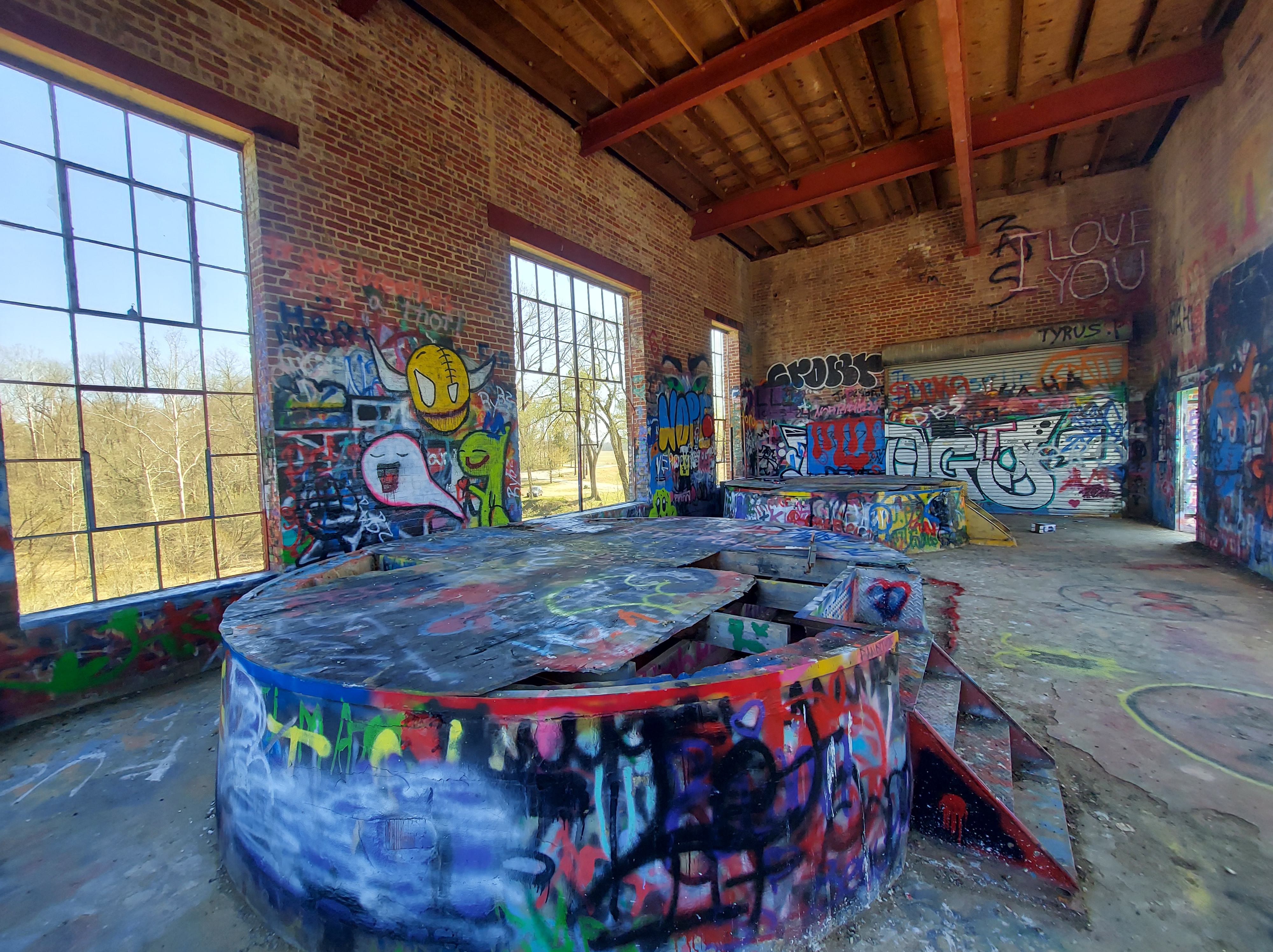
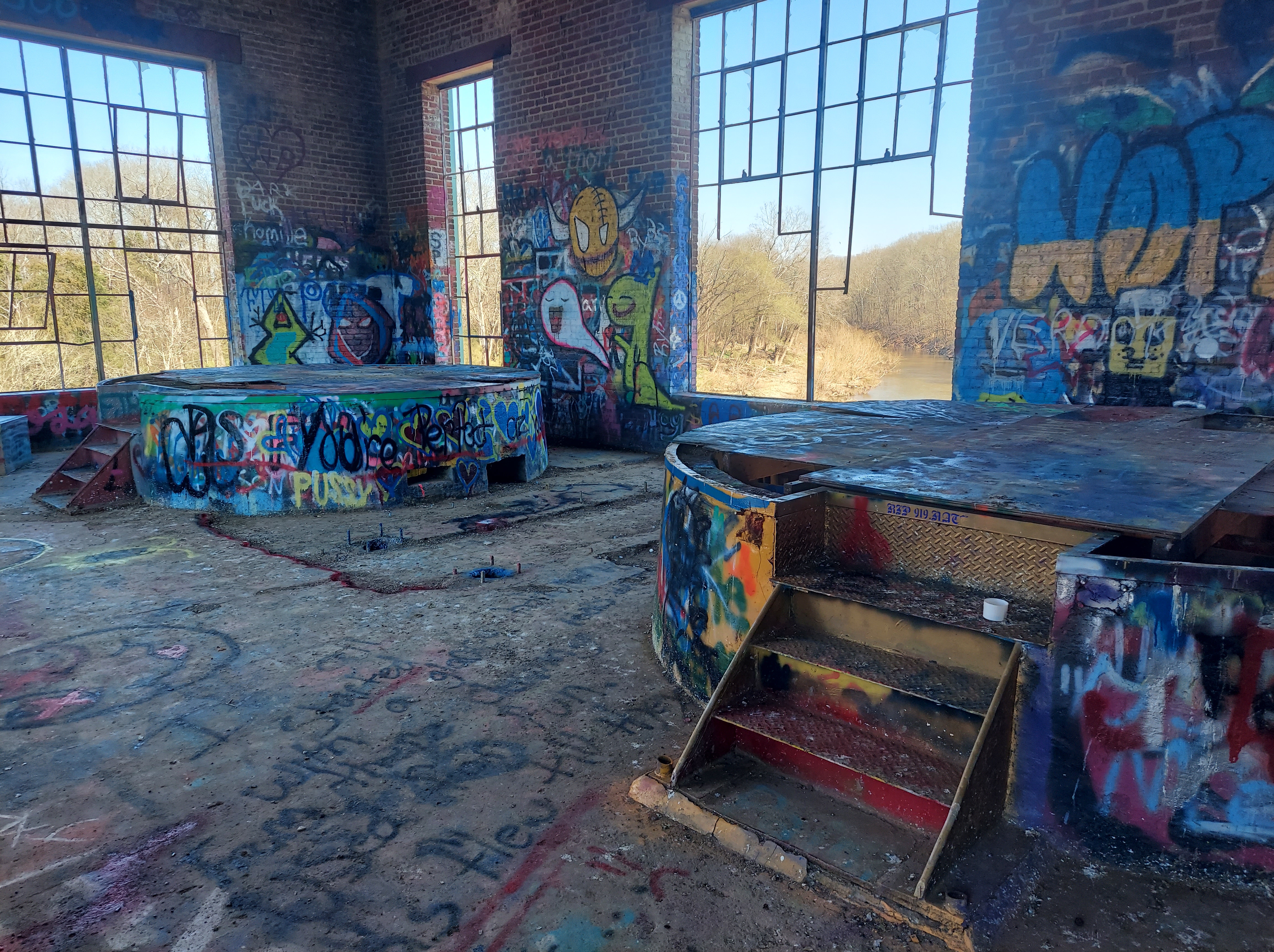
Inside the awesome room atop the powerhouse, while admiring the graffiti art and open river views from broken windows, I am joined by two guys, Thomas and John. They, like me, are visiting here for the first time and also enjoy exploring local abandoned sites. We all express our enjoyment of this building, of its significance and accessibility; then they tell me about several other places I now would like to visit. As I look out, a school bus stops and appears to drop off two kids with a fishing family.


The Carbonton dam site has been documented by Heather Leah for WRAL news and Atlas Obscura. These links contain photos of the low concrete dam and its powerhouse through its nearly 100 years.
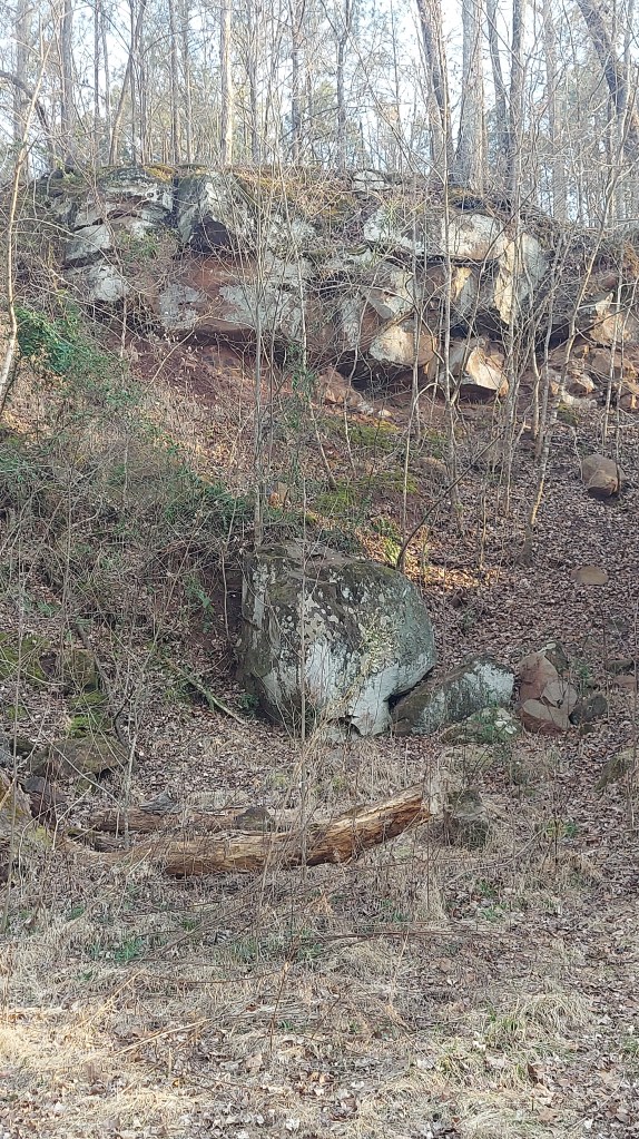
The river bends, then it bends again; in some spots the road goes through swamp land. There is no place to pull over and explore these. I know that swamps filled this area in the Triassic Period. The plants from these swamps decomposed and then were covered and eventually formed the coal seam.
COAL
The Deep River basin contains the only commercial coal mines in North Carolina. You may not know it, though, when passing through. However, there are historical signs and clues.

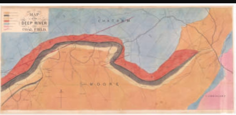
Peter Evans, who had a mill at the Carbonton site, incorporated LaGrange Mining company in the 1840s. He called the area “Egypt” after a year of drought, according to local legend, and then the mine adopted the name. Bituminous coal came out of Egypt Mine. It operated intermittently through the civil war and then the industrial boom period, with a 465-foot deep main shaft and 3 “slopes” at the time of the 1895 explosion. In that disaster, 40 of the 66 miners underground lost their lives. After this and another deadly accident in 1900, “Egypt” the mine and town changed their names to “Cumnock,” which is how it is known currently. The mine permanently closed by 1953 (possibly mined out), and I am told the shaft has been cemented shut. It’s on private land that is quite swampy.
Here are detailed historical articles about Egypt/Cumnock mine and the 1895 disaster (including maps) :
https://deepriverhistory.com/coal-field/egypt-coal-mine/
https://www.wikitree.com/wiki/Space:Cumnock_Mine_Disaster_1895
Across the river, the town of Farmville was established in the later 1800s. Carolina Coal Company opened Coal Glen mine in 1921. In May 1925, explosions in the mine resulted in at least 53 lives lost, making this North Carolina’s deadliest industrial disaster. The mine continued to operate until 1953 (also), and eventually, the river flooded the shaft. This spring will mark the 100th anniversary of the Coal Glen disaster.
https://en.m.wikipedia.org/wiki/Coal_Glen_mine_disaster
In the Deep River Basin, many families sold the mineral rights to their property to pay for taxes during the Great Depression, and significant coal mining occurred during the 1930’s.
-Reid, Jeffrey C. and Taylor, Kenneth B., 2009 “Shale gas potential in Triassic Strata of the Deep River Basin…” NGCS 1http://www.geology.enr.state.nc.us
According to maps, there were several mines in the Deep River coal field. None of them are operational or accessible in any way. Railroads wind through the basin across Carbonton, Glendon, Gulf, and Cumnock, used to transport the coal from these mines.

NATURAL GAS
These gray carbon-rich shale layers of the central Deep River basin also yield natural gas. (Natural gas typically is found in coal deposits.) In the 1990s a “shut-in” well was drilled near the river and Cumnock, and a pipeline was connected. Oil and natural gas companies do have operations in Lee County; there was discussion in the 2010s of a fracking boom and outside companies attempting to buy mineral rights in the basin.
Much of the natural gas used for energy in this area currently comes by pipeline from coal-rich states like West Virginia and Pennsylvania.
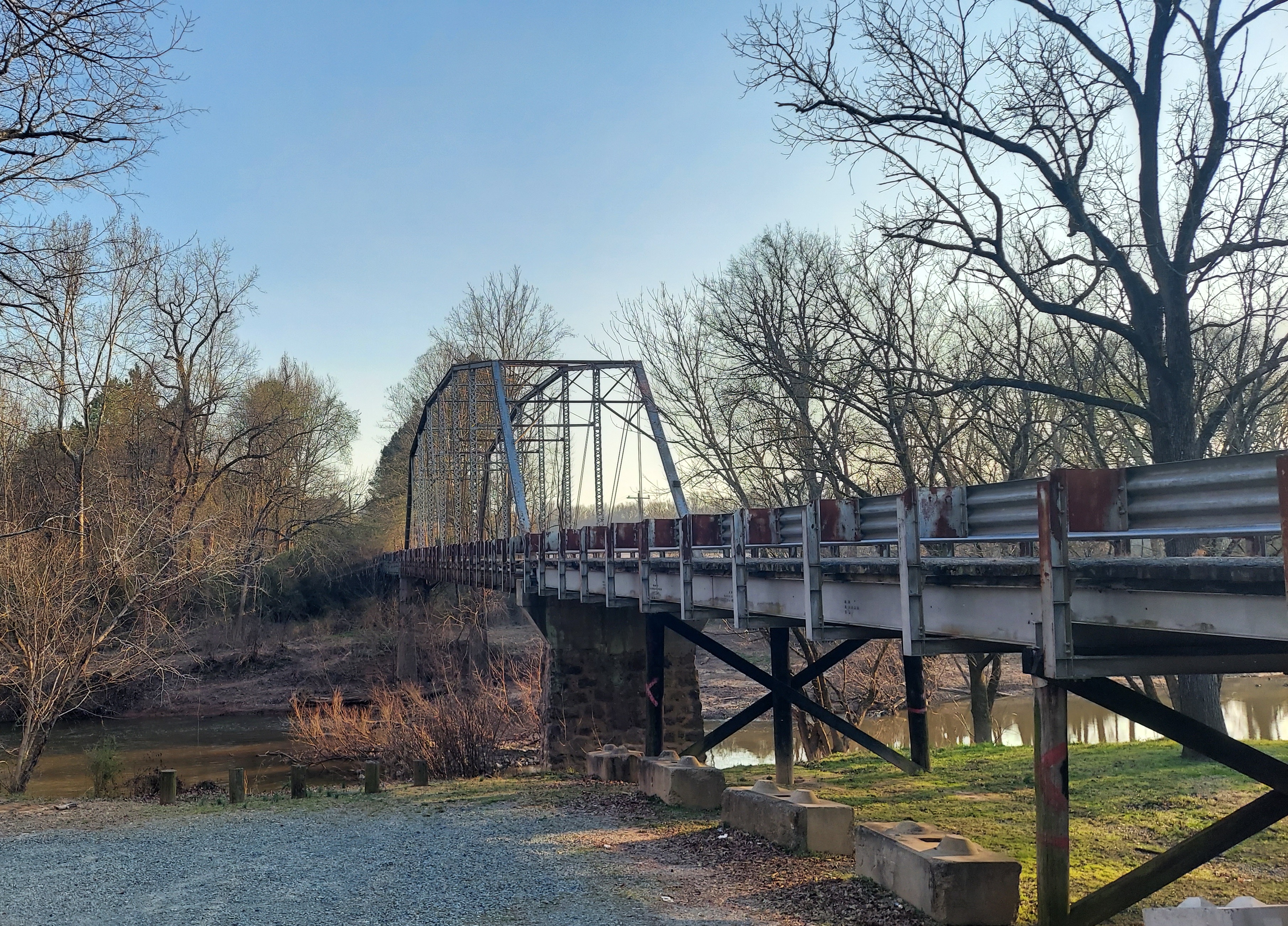
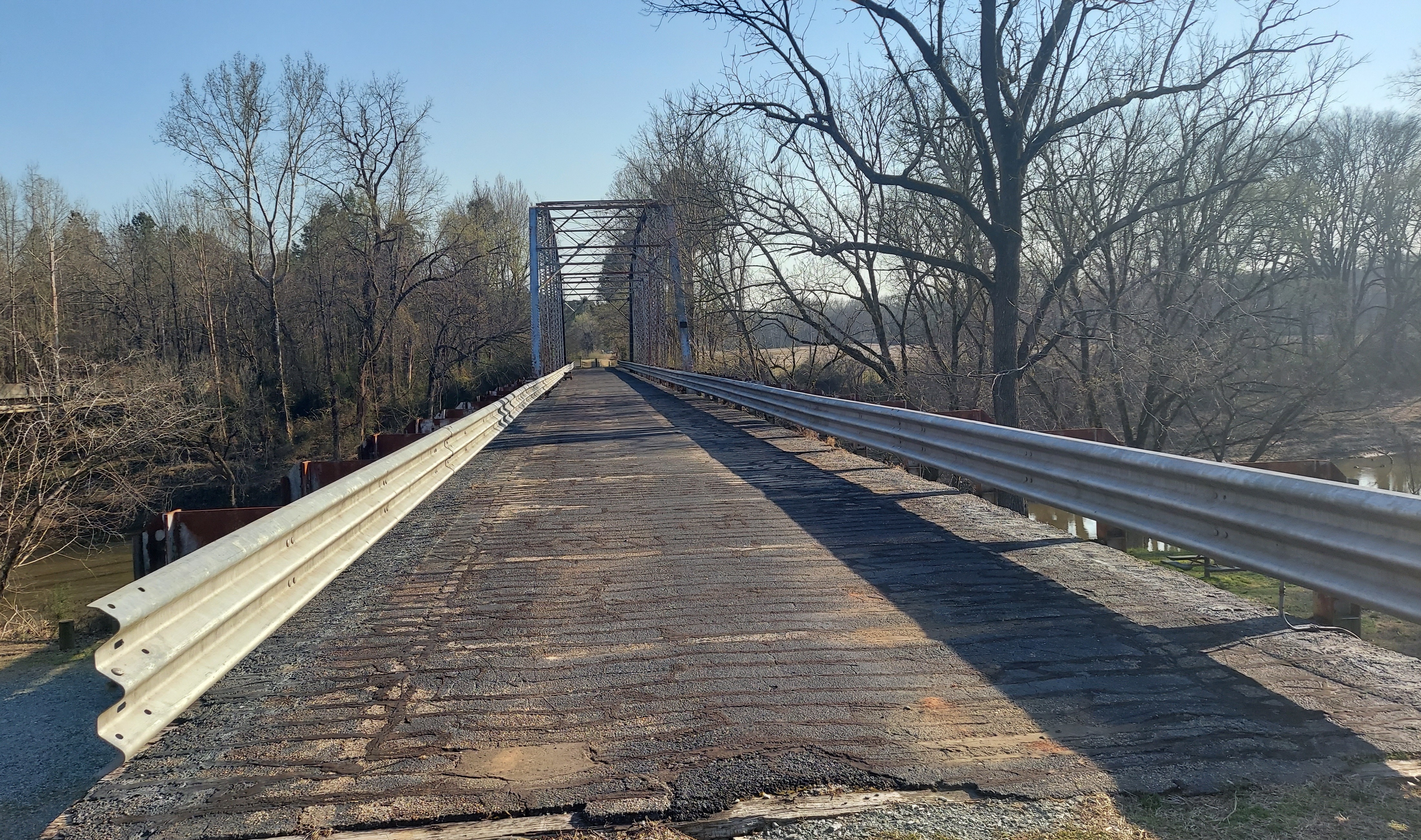
THE CUMNOCK BRIDGE
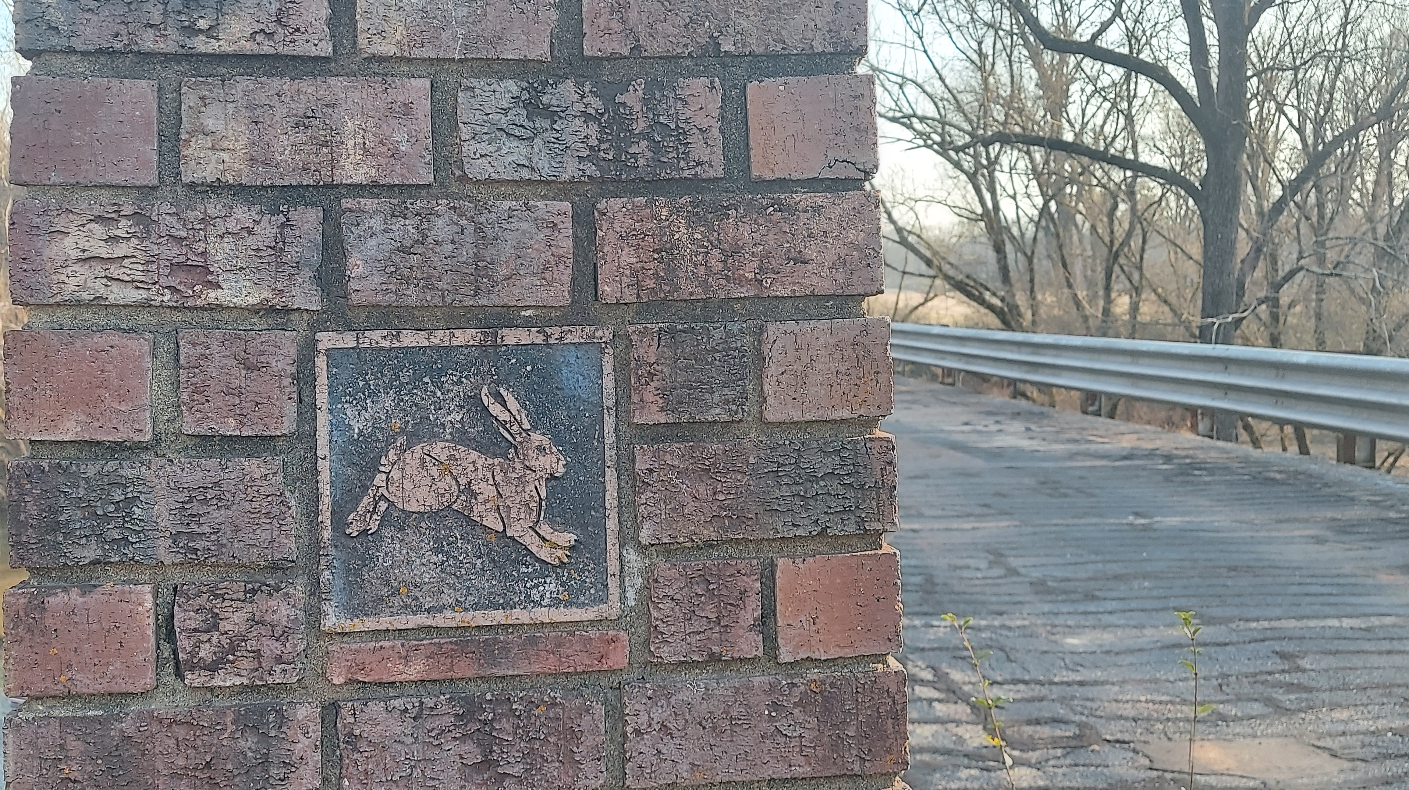
Cumnock Rd crosses Deep River north of the town near the former Egypt mine. The historic “camelback” bridge, built in 1910, has been preserved for pedestrians as part of Deep River park. As I approach the bridge after arriving at the park, I again encounter Thomas and John and we walk across the river and back. A notable feature of this bridge is the two decorated brick columns on each end; on the Chatham County side of the river (the main part of the park), the image is of a rabbit – a symbol of the county that resulted from flooding rivers and would have been relevant in 1910 – and a Lee County seal (I think) on that side.

In my previous post, I wrote about “brownstone,” the red sandstone used in building that was mined from quarries near here. On the Lee county end of the Cumnock Bridge, a large hand-painted sign shows a map of historic Brownstone quarries around Sanford. From a little research, it seems none of the quarries shown on the map still operate. However, in the late 1800s, brownstone from a Sanford quarry was used in building “brownstones” in New York, Philadelphia and Chicago.

Deep River park also has a small playground, picnic areas, a porta-potty, and a boat ramp. It’s beautiful here near sunset. On the bridge, I also meet Debbie Hall, a local resident who helps keep this park beautiful. She informs me of upcoming community events, which include river conservation meetings and memorials for the anniversaries of the Cumnock area coal mine disasters.
ENDOR IRON FURNACE
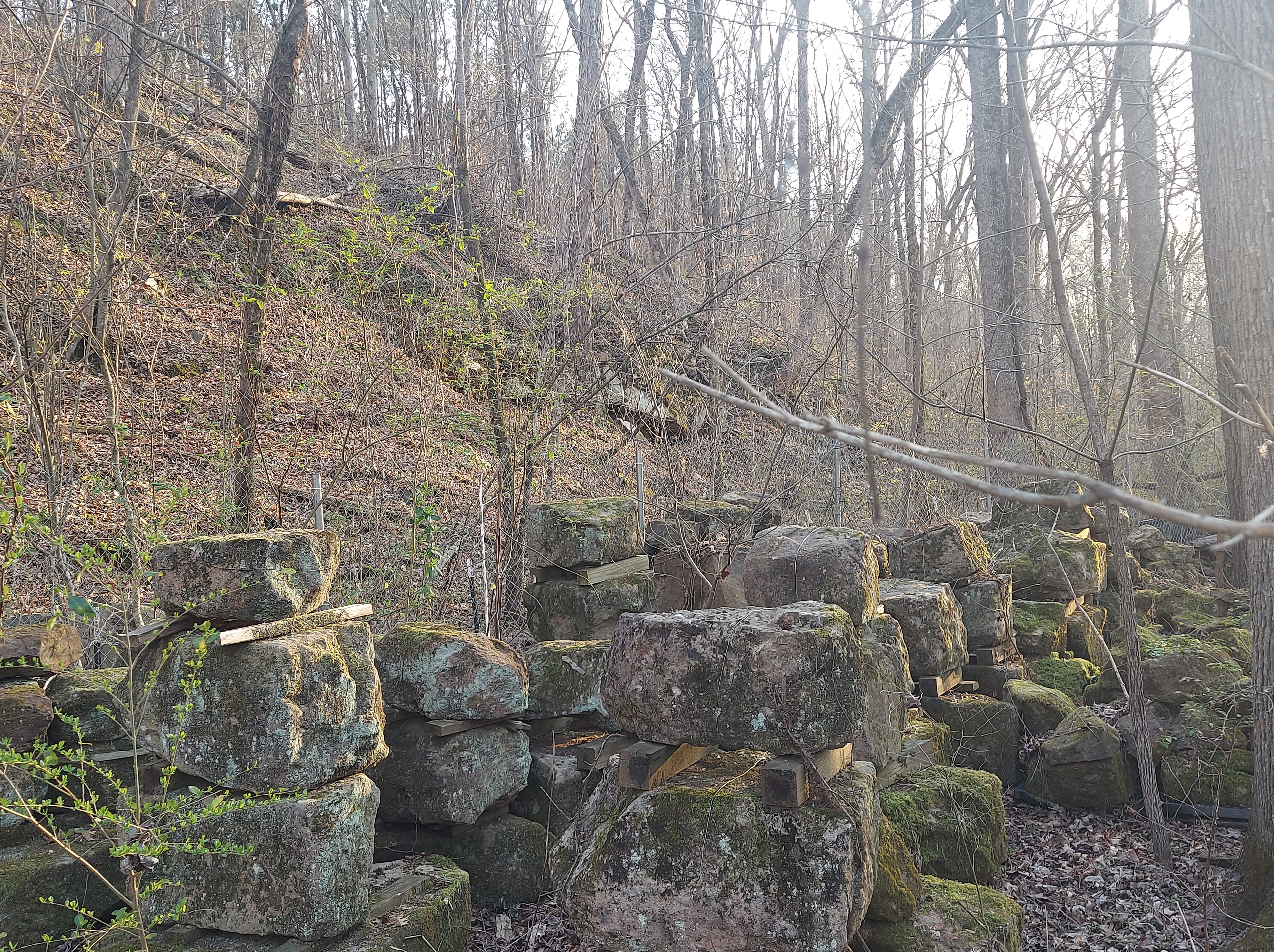
A mile or so downriver from the Cumnock bridge sits another historic site, the ruins of the “Endor Iron Furnace.” It’s near sunset, but that doesn’t stop me from trying to find it. The furnace is down a gravel road through the woods, across railroad tracks and at the foot of a rocky bluff. Hiking is involved (a short hike), and there are no signs with directions.
But the ruins are pretty awesome, hidden next to the river. This 35-foot tall furnace, made of the local brownstone, was built in the 1860s to make iron weapons in the civil war. Iron ore was brought from Buckhorn Mine (downriver on the Cape Fear toward Raven Rock), and heated with coal from Cumnock.


https://chathamhistory.org/Snippets-Chatham-History-Blog/13365404
DEEPER
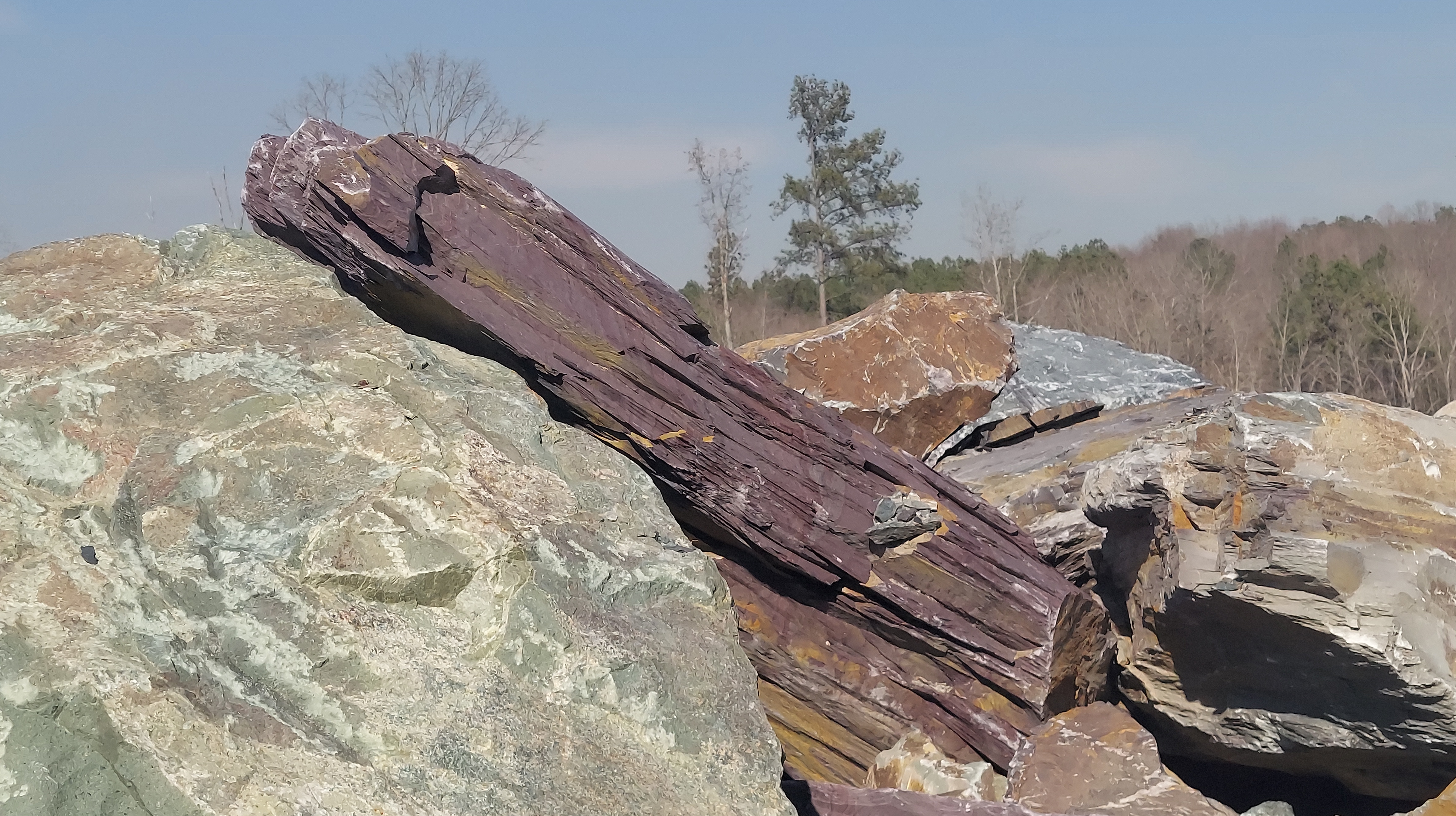
Beyond Carbonton, a noticeable incline marks the likely west edge of the rift basin. A crushed stone quarry near Glendon offers slate boulders by the truckload. I look out at the expanse of wooded hills and lowlands toward the east. Upriver, to the west-northwest, are the ruins of several mills and dams on natural falls of the sapponah, including one that bears its possible indigenous name.

Near Glendon, on the river’s most Southern bend, the House-in-the-Horseshoe (aka the Alston house) stands as a memory of wealth in the late 1700s, and hosted a shootout in 1781 as part of the Revolutionary war.

Sanford is on the eastern edge of the basin, built on a ridge for the railroad; it’s called “Brick City” and the earth is red. South of here lies the the Sandhills and its white/tan sediments.


Happy full worm moon and eclipse, and happy spring! Thank you for following me on this journey. This will continue….
MORE ABOUT THE DEEP RIVER:
About the river, its watershed and some history with a focus on natural conservation:
https://www.americanrivers.org/river/deep-river/
This article discusses and locates some of the mills along the river from the 1700s.
https://piedmonttrails.com/2019/07/01/early-settlers-on-the-banks-of-the-deep-river/
This blog article includes sections on coal mining, the bridge, and the furnace.
https://triangleland.org/explore/nature-preserves/mciver-landing-on-the-deep-river
About the history of Carbonton dam and historic mills (with a map and photo):
http://deepriver.pbworks.com/w/page/17134624/Carbonton%20Dam
About Endor Iron Furnace:
https://chathamhistory.org/Snippets-Chatham-History-Blog/13365404
Sanford Brick & Brownstone:
https://web.archive.org/web/20090216141238/http://downtownsanford.com/brickcapital_usa.htm
Geology and mineral resources in the Deep River Basin:
http://www.geology.enr.state.nc.us
About Triassic paleontology in NC:
https://www.wfdd.org/post/triassic-north-carolina
Carbonton Dam
54 Bobby Joe Ln, Sanford, NC 27330
GPS: 35.520427 N, -79.348911 W
Deep River Park
3485 R Jordan Rd, Sanford, NC 27330

One thought on “The Deep River and its Triassic Basin: Cumnock to Carbonton”